|
search place name
|
||
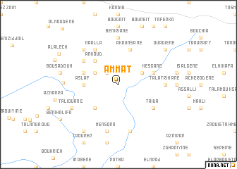
Ammat (Chaouen, Morocco)Ammat is a town in the Chaouen region of Morocco. An overview map of the region around Ammat is displayed below.
regional and 3d topo map of Ammat, Morocco ::
Ammat airports ::
The nearest airport is TTU - Tetouan Saniat Rmel, located 84.1 km north west of Ammat.
Other airports nearby include AHU - Al Hociema Cherif El Idrissi (105.9 km east), FEZ - Fez Saiss (107.9 km south), MEK - Meknes Bassatine (124.6 km south west), TNG - Tanger Ibn Batouta (127.1 km north west), Nearby towns ::
El Kribes (2.4km north west) //
Bab al ʼAziyib (3.6km north west) //
Tasiene (3.6km north east) //
Arouatene (4.8km south west) //
ʼAnkoûd (4.8km north west) //
Aslaf (4.6km west) //
Mesgane (4.9km east) //
El Blat (4.9km west) //
Akounsane (5.8km north) //
Akoumsâna (5.8km north) //
Taïda (5.9km south east) //
El Misab (5.9km north west) //
Maʼalla (6.3km north west) //
Beni Riane (7.4km north) //
Talarihane (6.1km east) //
Talʼat Rihane (6.1km east) //
Boulisene (7.6km south) //
Mensora (7.6km south) //
Bou Jaad (7.2km north west) //
Taliouane (7.1km south west) //
Gharbal (7.2km west) //
Mechines (8.7km south west) //
Ouadiene (8.2km north east) //
Almoudene (11.5km north west) //
[all distances 'as the bird flies' and approximate]  Places with similar names to Ammat, Morocco ::
Disclaimer :: Information on this page comes without warranty of any kind |
||
|
Where is Ammat? Elevation and coordinates ::
Latitude (lat): 34°54'0"N Longitude (lon): 4°57'0"W
Elevation (approx.): 546m (map arrows pan, magnifying glasses zoom) |
||
|
Visiting Ammat? Hotel/Accommodation ::
Book a hotel in Ammat Travel Guide ::
Buy a travel guide for Morocco rental cars ::
car rental offers GPS waypoint ::
download a GPX waypoint (PoI) of Ammat for your GPS receiver
|
||