|
search place name
|
||
Aourir nʼIrg (Taroudannt, Morocco)Aourir nʼIrg is a town in the Taroudannt region of Morocco. An overview map of the region around Aourir nʼIrg is displayed below.
regional and 3d topo map of Aourir nʼIrg, Morocco ::

Aourir nʼIrg airports ::
The nearest airport is RAK - Marrakech Menara, located 98.3 km north of Aourir nʼIrg.
Other airports nearby include AGA - Agadir Inezgane (126.4 km west), OZZ - Ouarzazate (134.7 km east), Nearby towns ::
Aït Hammou (NaNkm north) //
Sidi Bou Naga (NaNkm north) //
El Meddad (1.9km north) //
Bou Idourane (1.9km south) //
Aït Ali (1.9km south) //
Tagandourt (2.4km south east) //
Zaouia Sidi Ouâziz (3.2km west) //
Aït Ousseh (3.2km west) //
Ichourha (3.7km south) //
Targant nʼIfert (3.7km south) //
Amane nʼ Oulili (3.7km north west) //
Imrhez (4.0km north west) //
Ouilzane (4.0km north east) //
Aït Slimane (3.7km north east) //
Tadarine (3.7km north east) //
Aït Yaza (4.9km south west) //
Takoultemt (4.9km north west) //
Tamjercht (5.6km north) //
Agadir Iatouine (5.6km south) //
Agadir Boulnas (5.1km west) //
Tagadirt Bou Hamouch (5.1km east) //
Aït Youb (5.8km north) //
Imellalene (5.8km south) //
Tifert (6.0km north west) //
Aouftout (6.0km south west) //
Start nʼTberbout (6.0km south west) //
Tarezraft (6.4km south west) //
Tirhza (6.4km south east) //
Tagoudacht (7.4km north) //
[all distances 'as the bird flies' and approximate] 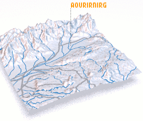 Places with similar names to Aourir nʼIrg, Morocco :: Disclaimer :: Information on this page comes without warranty of any kind |
||
|
Where is Aourir nʼIrg? Elevation and coordinates ::
Latitude (lat): 30°45'0"N Longitude (lon): 8°18'0"W
Elevation (approx.): 796m (map arrows pan, magnifying glasses zoom) |
||
|
Visiting Aourir nʼIrg? Hotel/Accommodation ::
Book a hotel in Aourir nʼIrg Travel Guide ::
Buy a travel guide for Morocco rental cars ::
car rental offers GPS waypoint ::
download a GPX waypoint (PoI) of Aourir nʼIrg for your GPS receiver
|
||