|
search place name
|
||
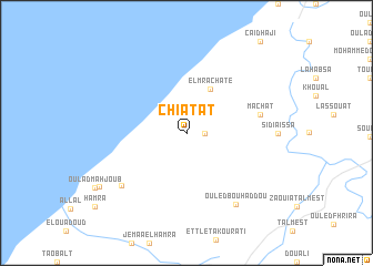
Chiatat (Essaouira, Morocco)Chiatat is a town in the Essaouira region of Morocco. An overview map of the region around Chiatat is displayed below.
regional and 3d topo map of Chiatat, Morocco ::
Chiatat airports ::
The nearest airport is RAK - Marrakech Menara, located 136.3 km east of Chiatat.
Other airports nearby include AGA - Agadir Inezgane (168.7 km south), CMN - Casablanca Mohammed V Intl (237.5 km north east), Nearby towns ::
El Mguedma (1.6km east) //
El Mrachate (4.8km north east) //
Mâchat (6.6km east) //
Oulad Mahjoub (7.7km south west) //
Ouled Bou Haddou (8.3km south east) //
El Mahetate (9.1km south west) //
[all distances 'as the bird flies' and approximate] 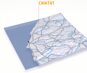 Places with similar names to Chiatat, Morocco ::
// Tiouddit (MA)
// Shadowwood (US)
// Chitid (RO)
// Chododa (RU)
// Shadīdah (IQ)
// Chāh Tūt (IR)
// Shadow Wood (US)
// Shadow Wood (US)
// Chhātādda (BD)
// Chitadda (BD)
Disclaimer :: Information on this page comes without warranty of any kind |
||
|
Where is Chiatat? Elevation and coordinates ::
Latitude (lat): 31°54'0"N Longitude (lon): 9°26'0"W
Elevation (approx.): 89m (map arrows pan, magnifying glasses zoom) |
||
|
Visiting Chiatat? Hotel/Accommodation ::
Book a hotel in Chiatat Travel Guide ::
Buy a travel guide for Morocco rental cars ::
car rental offers GPS waypoint ::
download a GPX waypoint (PoI) of Chiatat for your GPS receiver
|
||