|
search place name
|
||
Chraïr (Taroudannt, Morocco)Chraïr is a town in the Taroudannt region of Morocco. An overview map of the region around Chraïr is displayed below.
regional and 3d topo map of Chraïr, Morocco ::

Chraïr airports ::
The nearest airport is AGA - Agadir Inezgane, located 107.4 km west of Chraïr.
Other airports nearby include RAK - Marrakech Menara (110.9 km north), OZZ - Ouarzazate (153.3 km east), Nearby towns ::
Tizi nʼOumachou (NaNkm north) //
Oulad Zekri (2.4km north east) //
Oulad Barrehil (3.7km south) //
Foum Oucherg (3.2km west) //
Oulad Embarek (3.7km south east) //
Jerabia (4.0km south west) //
Oulad Krim (4.0km north east) //
Agadir Oudir (4.0km north east) //
Sidi Lahsene Ben Ayad (4.9km south east) //
Jeradat (4.9km south east) //
Oulad Fers (4.9km north east) //
Agoudal (4.9km south west) //
Talamt (4.8km west) //
Oulad Amrane (4.8km east) //
Aït Rakhou (5.1km east) //
Oulad Abbou (6.4km south east) //
Madida (6.4km south east) //
Oulad Mellouk (6.1km south west) //
Agadir el Hajj Hammou (6.1km south west) //
Oulad Amar Ben Ali (6.4km south west) //
Sidi Abdallah Ou Moussa (6.0km north east) //
Aït Zagoumas (6.4km east) //
Tagadirt (7.4km north) //
Zaouia Araz (6.4km west) //
Tamazt (7.6km south) //
Tagadirt nʼTarga (7.6km north) //
Sins (6.6km west) //
Tagadir Moulay Abd el Kader (7.3km south east) //
Dar Caïd (7.3km south west) //
[all distances 'as the bird flies' and approximate] 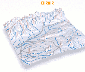 Places with similar names to Chraïr, Morocco ::
Disclaimer :: Information on this page comes without warranty of any kind |
||
|
Where is Chraïr? Elevation and coordinates ::
Latitude (lat): 30°41'0"N Longitude (lon): 8°29'0"W
Elevation (approx.): 554m (map arrows pan, magnifying glasses zoom) |
||
|
Visiting Chraïr? Hotel/Accommodation ::
Book a hotel in Chraïr Travel Guide ::
Buy a travel guide for Morocco rental cars ::
car rental offers GPS waypoint ::
download a GPX waypoint (PoI) of Chraïr for your GPS receiver
|
||