|
search place name
|
||
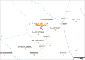
Dlalja (Settat, Morocco)Dlalja is a town in the Settat region of Morocco. An overview map of the region around Dlalja is displayed below.
regional and 3d topo map of Dlalja, Morocco ::
Dlalja airports ::
The nearest airport is CMN - Casablanca Mohammed V Intl, located 33.2 km west of Dlalja.
Other airports nearby include RBA - Rabat Sale (89.7 km north east), NNA - Kentira Kenitra (120.7 km north east), MEK - Meknes Bassatine (169.9 km east), RAK - Marrakech Menara (207.5 km south), Nearby towns ::
Ouled Mansour (2.4km south west) //
Sidi Ahmed el Rhandour (2.4km north west) //
Ouled Hadad (3.7km north) //
Ouled Sidi Ahmed (4.0km north east) //
Magouss (4.0km south east) //
Ouled Aouda (4.6km east) //
Ouled Ben Smaïn (5.8km south) //
Caïdel Mekki (7.5km south) //
El Gara (8.1km south) //
Dar el Haj Ben Haj (10.6km south west) //
[all distances 'as the bird flies' and approximate]  Places with similar names to Dlalja, Morocco ::
Disclaimer :: Information on this page comes without warranty of any kind |
||
|
Where is Dlalja? Elevation and coordinates ::
Latitude (lat): 33°21'0"N Longitude (lon): 7°14'0"W
Elevation (approx.): 232m (map arrows pan, magnifying glasses zoom) |
||
|
Visiting Dlalja? Hotel/Accommodation ::
Book a hotel in Dlalja Travel Guide ::
Buy a travel guide for Morocco rental cars ::
car rental offers GPS waypoint ::
download a GPX waypoint (PoI) of Dlalja for your GPS receiver
|
||