|
search place name
|
||
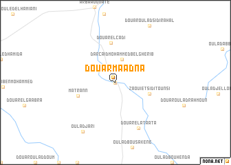
Douar Maadna (El Jadida, Morocco)Douar Maadna is a town in the El Jadida region of Morocco. An overview map of the region around Douar Maadna is displayed below.
regional and 3d topo map of Douar Maadna, Morocco ::
Douar Maadna airports ::
The nearest airport is CMN - Casablanca Mohammed V Intl, located 97.6 km north east of Douar Maadna.
Other airports nearby include RAK - Marrakech Menara (114.5 km south), RBA - Rabat Sale (205.2 km north east), OZZ - Ouarzazate (222.4 km south east), NNA - Kentira Kenitra (235.5 km north east), Nearby towns ::
Dar Caïd Tounsi (0.0km north) //
Dar Caïd Mohammed Bel Gherib (3.9km north) //
Zaouiet Sidi Tounsi (5.0km east) //
Douar el Cadi (6.4km north) //
Matrann (5.6km south west) //
Douar el Ataata (8.0km south east) //
Oulad Jari (9.2km south west) //
[all distances 'as the bird flies' and approximate]  Places with similar names to Douar Maadna, Morocco ::
// Dar Moueddine (MA)
// Dayr Umm Tūnah (IQ)
// Trimódion (GR)
// Tremtiniai (LT)
// Douar Oum et Tine (TN)
// Torremediana (ES)
// Dar Mādān (IR)
// Dar Mouddene (MA)
// Drom Aidhne (IE)
// Tre Madonne (IT)
Disclaimer :: Information on this page comes without warranty of any kind |
||
|
Where is Douar Maadna? Elevation and coordinates ::
Latitude (lat): 32°38'0"N Longitude (lon): 8°10'0"W
Elevation (approx.): 241m (map arrows pan, magnifying glasses zoom) |
||
|
Visiting Douar Maadna? Hotel/Accommodation ::
Book a hotel in Douar Maadna Travel Guide ::
Buy a travel guide for Morocco rental cars ::
car rental offers GPS waypoint ::
download a GPX waypoint (PoI) of Douar Maadna for your GPS receiver
|
||