|
search place name
|
||
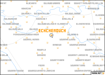
Ech Chemouch (Sidi Kacem, Morocco)Ech Chemouch is a town in the Sidi Kacem region of Morocco. An overview map of the region around Ech Chemouch is displayed below.
regional and 3d topo map of Ech Chemouch, Morocco ::
Ech Chemouch airports ::
The nearest airport is MEK - Meknes Bassatine, located 57.0 km south of Ech Chemouch.
Other airports nearby include FEZ - Fez Saiss (78.8 km south east), NNA - Kentira Kenitra (89.1 km west), RBA - Rabat Sale (109.4 km west), TTU - Tetouan Saniat Rmel (137.4 km north), Nearby towns ::
Douar Oulad Bouares (2.4km south west) //
Oulad Bou Azza (2.4km north east) //
Aïn Beïda (4.0km south) //
Oulad Bou el Hsaïn (4.0km north) //
El Habata (4.8km north east) //
Larbi Nessiri (4.6km east) //
Oulad Khraïs (5.6km north) //
Douar Hajj Saïd (4.9km east) //
Oulad Sellam (4.9km west) //
El Haji (4.9km east) //
Nouafla (6.3km south west) //
Khenichet (6.3km north west) //
Oulad Saïd (6.1km east) //
Douar el Merani (6.4km west) //
Oulad Jellal (7.2km south west) //
Aïn el Kelb (7.2km north east) //
Somhane (8.0km south) //
Oulad Saïd (8.0km north) //
Karia ed Douadi (8.0km north) //
Oulad Msellam (8.0km north) //
Oulad el Ahmar (9.6km north east) //
[all distances 'as the bird flies' and approximate] 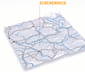 Places with similar names to Ech Chemouch, Morocco :: Disclaimer :: Information on this page comes without warranty of any kind |
||
|
Where is Ech Chemouch? Elevation and coordinates ::
Latitude (lat): 34°23'0"N Longitude (lon): 5°38'0"W
Elevation (approx.): 120m (map arrows pan, magnifying glasses zoom) |
||
|
Visiting Ech Chemouch? Hotel/Accommodation ::
Book a hotel in Ech Chemouch Travel Guide ::
Buy a travel guide for Morocco rental cars ::
car rental offers GPS waypoint ::
download a GPX waypoint (PoI) of Ech Chemouch for your GPS receiver
|
||