|
search place name
|
||
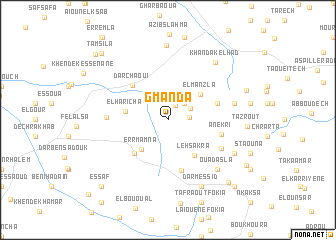
Gmanda (Tétouan, Morocco)Gmanda is a town in the Tétouan region of Morocco. An overview map of the region around Gmanda is displayed below.
regional and 3d topo map of Gmanda, Morocco ::
Gmanda airports ::
The nearest airport is TNG - Tanger Ibn Batouta, located 32.9 km north west of Gmanda.
Other airports nearby include TTU - Tetouan Saniat Rmel (34.6 km east), GIB - Gibraltar (78.3 km north), XRY - Jerez (142.2 km north), NNA - Kentira Kenitra (157.2 km south west), Nearby towns ::
Bezouala (1.7km north east) //
Bou Ghabech (1.9km east) //
El Menaset (2.4km north east) //
Aïn Kalboun (2.4km north east) //
Es Skhra (2.5km north east) //
Er Rmamna (4.1km south west) //
El Manzla (4.1km north east) //
El Haricha (3.9km west) //
Lehsakra (4.7km south east) //
Harcha (4.8km south west) //
Aïn Ninou (4.8km south west) //
Beni Hatem (4.8km south west) //
Dar Chaoui (5.0km north west) //
Skarrich (5.8km south) //
Herarsa (4.9km east) //
Anekri (5.1km east) //
Tmanech (5.8km south east) //
El Hajeriyene (5.6km west) //
Agral (6.3km east) //
Ouadasla (7.2km south east) //
El Maghghara (8.3km north) //
Edchera (7.1km south east) //
Dâr Messid (8.0km south) //
Khandak el Had (7.7km north east) //
Ahouchane (7.9km north east) //
Fejjerih (8.9km south east) //
Fejj Hannoun (8.8km south east) //
Zaouia Fokia (9.6km south east) //
Tamsila (9.6km north west) //
[all distances 'as the bird flies' and approximate] 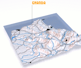 Places with similar names to Gmanda, Morocco ::
Disclaimer :: Information on this page comes without warranty of any kind |
||
|
Where is Gmanda? Elevation and coordinates ::
Latitude (lat): 35°30'0"N Longitude (lon): 5°41'0"W
Elevation (approx.): 206m (map arrows pan, magnifying glasses zoom) |
||
|
Visiting Gmanda? Hotel/Accommodation ::
Book a hotel in Gmanda Travel Guide ::
Buy a travel guide for Morocco rental cars ::
car rental offers GPS waypoint ::
download a GPX waypoint (PoI) of Gmanda for your GPS receiver
|
||