|
search place name
|
||
Gueha ez Zerga (Khemisset, Morocco)Gueha ez Zerga is a town in the Khemisset region of Morocco. An overview map of the region around Gueha ez Zerga is displayed below.
regional and 3d topo map of Gueha ez Zerga, Morocco ::

Gueha ez Zerga airports ::
The nearest airport is TTA - Tan Tan Plage Blanche, located 27.4 km west of Gueha ez Zerga.
Other airports nearby include AGA - Agadir Inezgane (245.7 km north east), Nearby towns ::
Aïn Kerma (3.8km east) //
[all distances 'as the bird flies' and approximate] 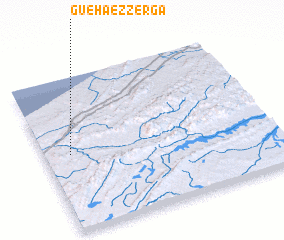 Places with similar names to Gueha ez Zerga, Morocco ::
// Khosrekh (RU)
// Khisarak (UZ)
// Khozarek (TM)
// Khosrak (IR)
// Kūh-e Sorkh (IR)
// (( Khisarak )) (UZ)
Disclaimer :: Information on this page comes without warranty of any kind |
||
|
Where is Gueha ez Zerga? Elevation and coordinates ::
Latitude (lat): 28°30'5"N Longitude (lon): 10°53'16"W
Elevation (approx.): 18m (map arrows pan, magnifying glasses zoom) |
||
|
Visiting Gueha ez Zerga? Hotel/Accommodation ::
Book a hotel in Gueha ez Zerga Travel Guide ::
Buy a travel guide for Morocco rental cars ::
car rental offers GPS waypoint ::
download a GPX waypoint (PoI) of Gueha ez Zerga for your GPS receiver
|
||