|
search place name
|
||
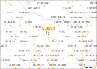
Guissa (Sidi Kacem, Morocco)Guissa is a town in the Sidi Kacem region of Morocco. An overview map of the region around Guissa is displayed below.
regional and 3d topo map of Guissa, Morocco ::
Guissa airports ::
The nearest airport is TTU - Tetouan Saniat Rmel, located 90.1 km north east of Guissa.
Other airports nearby include TNG - Tanger Ibn Batouta (92.1 km north), NNA - Kentira Kenitra (96.6 km south west), MEK - Meknes Bassatine (117.0 km south), RBA - Rabat Sale (126.4 km south west), Nearby towns ::
Bastioun (1.5km west) //
Demna (1.9km south) //
Ketama (1.9km north) //
Beni Khellad (2.4km north east) //
Berraguine (2.4km south east) //
Zaouia Ali Ben Ahmed (2.4km south east) //
Beni Helma (2.4km north west) //
Sourhmari (3.6km north west) //
Ras el Mekil (4.8km south east) //
Mimouna (4.8km north east) //
Oulad Hajaj (5.6km south) //
Châab (4.6km east) //
Nehal (4.6km east) //
Oulad Ben Saʼid (5.8km south) //
Doumyine (4.9km west) //
Oulad Yahia (5.9km south west) //
Khendeq Hamra (6.3km north east) //
Chtaouna (6.1km west) //
Dchar (6.4km east) //
Zrazer (6.4km east) //
Chiabna (6.4km west) //
Grouna (7.2km south west) //
Beni Maafa (7.2km north east) //
Sebbab (7.1km north east) //
Beni Hassene (8.0km south) //
Krazza (7.1km north west) //
El Jorf (8.0km south) //
El Bouhata (8.2km north west) //
Dkakla (9.6km north west) //
[all distances 'as the bird flies' and approximate] 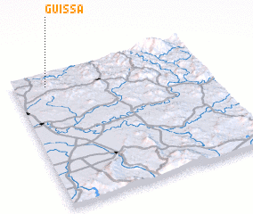 Places with similar names to Guissa, Morocco ::
Disclaimer :: Information on this page comes without warranty of any kind |
||
|
Where is Guissa? Elevation and coordinates ::
Latitude (lat): 34°54'0"N Longitude (lon): 5°50'0"W
Elevation (approx.): 148m (map arrows pan, magnifying glasses zoom) |
||
|
Visiting Guissa? Hotel/Accommodation ::
Book a hotel in Guissa Travel Guide ::
Buy a travel guide for Morocco rental cars ::
car rental offers GPS waypoint ::
download a GPX waypoint (PoI) of Guissa for your GPS receiver
|
||