|
search place name
|
||
Id Tajet (Tiznit, Morocco)Id Tajet is a town in the Tiznit region of Morocco. An overview map of the region around Id Tajet is displayed below.
regional and 3d topo map of Id Tajet, Morocco ::

Id Tajet airports ::
The nearest airport is AGA - Agadir Inezgane, located 107.2 km north of Id Tajet.
Other airports nearby include TTA - Tan Tan Plage Blanche (174.4 km south west), TIN - Tindouf (247.7 km south east), Nearby towns ::
Taberbakt (3.7km south west) //
Id Ouanezid (3.7km north west) //
Id Begra (4.9km south west) //
Id Aïssa (4.9km north west) //
Oualga (4.9km north east) //
Id Berka (5.8km south) //
Id Cheïne (5.2km west) //
Id Lyazid (5.8km south) //
Anammer (6.1km north east) //
Tafraout nʼAït Daoud (6.5km west) //
Bou Yahya (6.5km west) //
Id Ou Rhremouch (6.5km east) //
Lahallat (7.6km south) //
Id Daoua (7.6km north) //
Id Saïd Ou Mbark (7.4km north west) //
Imerzag (7.4km south west) //
Id Aïssa (7.4km south east) //
Id Bou Hammou (8.1km south west) //
Tiferdine (7.4km north west) //
Id Ou Bella (7.4km south east) //
Id Baïr (8.5km south west) //
Tigouar (8.9km south west) //
El Argoub (8.5km north east) //
Id Ou Bella (9.8km north east) //
Id Ou Mghar (9.9km north west) //
[all distances 'as the bird flies' and approximate] 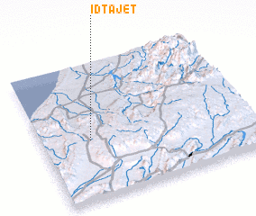 Places with similar names to Id Tajet, Morocco :: Disclaimer :: Information on this page comes without warranty of any kind |
||
|
Where is Id Tajet? Elevation and coordinates ::
Latitude (lat): 29°26'0"N Longitude (lon): 9°46'0"W
Elevation (approx.): 769m (map arrows pan, magnifying glasses zoom) |
||
|
Visiting Id Tajet? Hotel/Accommodation ::
Book a hotel in Id Tajet Travel Guide ::
Buy a travel guide for Morocco rental cars ::
car rental offers GPS waypoint ::
download a GPX waypoint (PoI) of Id Tajet for your GPS receiver
|
||