|
search place name
|
||
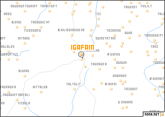
Igafaïn (Taroudannt, Morocco)Igafaïn is a town in the Taroudannt region of Morocco. An overview map of the region around Igafaïn is displayed below.
regional and 3d topo map of Igafaïn, Morocco ::
Igafaïn airports ::
The nearest airport is AGA - Agadir Inezgane, located 108.5 km west of Igafaïn.
Other airports nearby include RAK - Marrakech Menara (171.8 km north), OZZ - Ouarzazate (175.8 km north east), Nearby towns ::
Lalla Aïcha (0.2km south west) //
Igherm (1.9km south) //
Timichcha (2.1km east) //
Amane Tazert (2.4km north west) //
Tagragra (4.1km south east) //
Aniloul (5.5km north) //
Ighil Issimsidene (5.8km north) //
Ouine Tataïn (5.9km north east) //
Tanamert (6.7km north) //
Imni (6.1km north east) //
Tanejajamcht (6.7km south east) //
Taltslit (7.2km south) //
Ifesfes (6.3km east) //
Ouaremdaz (7.3km south) //
Tioujgaline (6.6km east) //
Tifelsine (8.2km north) //
Tazarine (8.3km north east) //
Imni (8.3km north east) //
Tig Natine (8.2km east) //
Imi n Ifri (9.0km south east) //
Anammer (9.1km south east) //
[all distances 'as the bird flies' and approximate] 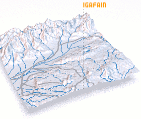
Disclaimer :: Information on this page comes without warranty of any kind |
||
|
Where is Igafaïn? Elevation and coordinates ::
Latitude (lat): 30°6'7"N Longitude (lon): 8°27'56"W
Elevation (approx.): 1715m (map arrows pan, magnifying glasses zoom) |
||
|
Visiting Igafaïn? Hotel/Accommodation ::
Book a hotel in Igafaïn Travel Guide ::
Buy a travel guide for Morocco rental cars ::
car rental offers GPS waypoint ::
download a GPX waypoint (PoI) of Igafaïn for your GPS receiver
|
||