|
search place name
|
||
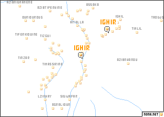
Ighir (Ouarzazate, Morocco)Ighir is a town in the Ouarzazate region of Morocco. An overview map of the region around Ighir is displayed below.
regional and 3d topo map of Ighir, Morocco ::
Ighir airports ::
The nearest airport is OZZ - Ouarzazate, located 56.9 km south west of Ighir.
Other airports nearby include RAK - Marrakech Menara (148.8 km west), Nearby towns ::
Aït Boulmane (0.6km north) //
Aguerd (0.6km south) //
Ihajamene (1.3km north) //
Aït Nasser (1.8km south) //
Lmi nʼTawarda (2.3km north) //
Aït Ben Taʼazza (2.5km south) //
Ifrane (2.7km north) //
Aït Moudzit (2.7km north east) //
Aït Hasseïn (2.9km south) //
Ouaoumeloud (3.6km north) //
Aguerd nʼIgherm (3.8km north) //
Aït Temassaï (4.0km south) //
Aït Oumerezou (4.0km south) //
Tassouggaït (4.3km south) //
Tasga (4.8km south) //
Bourmmane (4.8km north) //
Tarhia nʼAssermo (4.4km west) //
Targat nʼAda (5.3km south) //
Tafrout (4.5km west) //
Imezil (5.4km north) //
Amerzou (5.6km south) //
Ignane (4.9km west) //
Taourirt (5.7km south) //
Agoudim (5.1km west) //
Azib Tanoughzirt (5.5km north west) //
Aït Hammou (6.3km north) //
Aligh nʼTarga (6.5km south) //
Imi nʼOulaoun (6.6km north) //
Aït Ouznag (5.7km west) //
[all distances 'as the bird flies' and approximate] 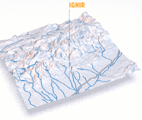 Places with similar names to Ighir, Morocco ::
Disclaimer :: Information on this page comes without warranty of any kind |
||
|
Where is Ighir? Elevation and coordinates ::
Latitude (lat): 31°19'7"N Longitude (lon): 6°30'27"W
Elevation (approx.): 1648m (map arrows pan, magnifying glasses zoom) |
||
|
Visiting Ighir? Hotel/Accommodation ::
Book a hotel in Ighir Travel Guide ::
Buy a travel guide for Morocco rental cars ::
car rental offers GPS waypoint ::
download a GPX waypoint (PoI) of Ighir for your GPS receiver
|
||