|
search place name
|
||
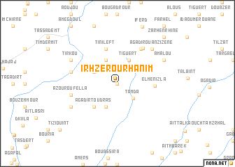
Irhzer Ou Rhanim (Taroudannt, Morocco)Irhzer Ou Rhanim is a town in the Taroudannt region of Morocco. An overview map of the region around Irhzer Ou Rhanim is displayed below.
regional and 3d topo map of Irhzer Ou Rhanim, Morocco ::
Irhzer Ou Rhanim airports ::
The nearest airport is AGA - Agadir Inezgane, located 47.5 km south west of Irhzer Ou Rhanim.
Other airports nearby include RAK - Marrakech Menara (151.7 km north east), Nearby towns ::
Tikhibit Izder (0.0km north) //
Tamda (3.2km south east) //
Tiguert (4.0km north east) //
Ouaoussekht (4.0km north west) //
Ida Ou Kess Oufella (3.7km north west) //
Irhourba (4.0km south west) //
Agadir Toudras (4.9km south west) //
Tinileft (5.8km north) //
El Menizla (5.2km east) //
Iggounane (6.4km north east) //
Loummih (6.6km north east) //
Tanamert (6.6km west) //
Azour Oufella (6.6km west) //
Agadir Ouanzizene (7.3km north east) //
Amalou (7.4km north east) //
Tirkou (7.4km north west) //
Azour Ouzedder (7.4km south west) //
Zarhenrhine (9.8km north east) //
[all distances 'as the bird flies' and approximate] 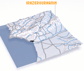 Places with similar names to Irhzer Ou Rhanim, Morocco :: Disclaimer :: Information on this page comes without warranty of any kind |
||
|
Where is Irhzer Ou Rhanim? Elevation and coordinates ::
Latitude (lat): 30°37'0"N Longitude (lon): 9°8'0"W
Elevation (approx.): 604m (map arrows pan, magnifying glasses zoom) |
||
|
Visiting Irhzer Ou Rhanim? Hotel/Accommodation ::
Book a hotel in Irhzer Ou Rhanim Travel Guide ::
Buy a travel guide for Morocco rental cars ::
car rental offers GPS waypoint ::
download a GPX waypoint (PoI) of Irhzer Ou Rhanim for your GPS receiver
|
||