|
search place name
|
||
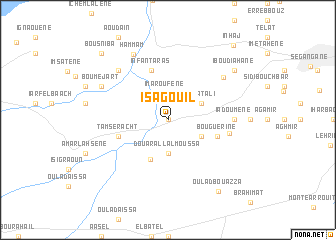
Isagouil (Nador, Morocco)Isagouil is a town in the Nador region of Morocco. An overview map of the region around Isagouil is displayed below.
regional and 3d topo map of Isagouil, Morocco ::
Isagouil airports ::
The nearest airport is MLN - Melilla, located 26.6 km north east of Isagouil.
Other airports nearby include AHU - Al Hociema Cherif El Idrissi (63.4 km west), OUD - Oujda Angads (117.3 km east), TLM - Tlemcen Zenata (155.4 km east), LEI - Almeria (205.9 km north), Nearby towns ::
Ibousatene (0.0km north) //
Imaroufene (2.9km north) //
Douar Allal Moussa (3.7km south) //
Hajâtʼ ali (3.6km north east) //
Haddou Allal Ou Kaddour (3.6km south east) //
Iboûhjarene (4.6km south) //
Infantaras (5.8km north) //
Bouguerine (4.9km east) //
Tamseracht (4.9km west) //
Iboughardaïn (5.8km east) //
Iadoumene (6.1km east) //
Jhoachrene (7.2km north west) //
I-n Haddoû (7.0km north east) //
Hammam (7.9km north west) //
Bou Mejart (7.1km north west) //
Ehahdousene (8.2km north east) //
Iboudiahane (8.2km north east) //
Oulad Boû ʼAzza (9.2km south east) //
Bousniba (9.6km north west) //
I-n- Hâj (10.3km north east) //
[all distances 'as the bird flies' and approximate] 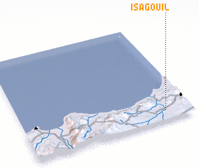 Places with similar names to Isagouil, Morocco ::
Disclaimer :: Information on this page comes without warranty of any kind |
||
|
Where is Isagouil? Elevation and coordinates ::
Latitude (lat): 35°6'0"N Longitude (lon): 3°9'0"W
Elevation (approx.): 109m (map arrows pan, magnifying glasses zoom) |
||
|
Visiting Isagouil? Hotel/Accommodation ::
Book a hotel in Isagouil Travel Guide ::
Buy a travel guide for Morocco rental cars ::
car rental offers GPS waypoint ::
download a GPX waypoint (PoI) of Isagouil for your GPS receiver
|
||