|
search place name
|
||
Kebhach (Tétouan, Morocco)Kebhach is a town in the Tétouan region of Morocco. An overview map of the region around Kebhach is displayed below.
regional and 3d topo map of Kebhach, Morocco ::

Kebhach airports ::
The nearest airport is TTU - Tetouan Saniat Rmel, located 37.1 km north of Kebhach.
Other airports nearby include TNG - Tanger Ibn Batouta (73.9 km north west), GIB - Gibraltar (98.9 km north), AHU - Al Hociema Cherif El Idrissi (136.5 km east), FEZ - Fez Saiss (151.5 km south), Nearby towns ::
Cherouta (0.7km north) //
Kouebbach (0.7km north) //
Zaouia (2.7km north west) //
Chaouia (2.9km north west) //
Arbada (3.0km west) //
Oulad Didous (3.2km north east) //
Dar Akoba (3.4km south east) //
Tassart (3.2km north east) //
Ardifene (3.1km west) //
Dar Amalal (3.4km south east) //
Bouaouene (4.1km north east) //
Arifane (4.2km north east) //
Jemaa el Jir (4.9km south) //
Boaouene (4.7km north) //
Ichtal (4.8km east) //
Issoumatene (5.8km north) //
Bala (5.4km north east) //
Adayourha (5.6km west) //
Adayougha (5.6km west) //
Hastalla (5.8km south east) //
Caotina (6.9km south) //
Boubiyene (6.4km south west) //
El Maouzkir (6.6km south west) //
Asahadene (6.5km south west) //
Ichela (6.0km west) //
Seflia (6.7km south east) //
Foukia (6.7km south east) //
Emkhams Amsiene (7.3km south west) //
Talamkrene (6.2km east) //
[all distances 'as the bird flies' and approximate] 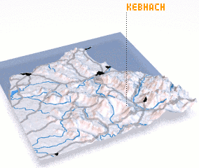 Places with similar names to Kebhach, Morocco :: Disclaimer :: Information on this page comes without warranty of any kind |
||
|
Where is Kebhach? Elevation and coordinates ::
Latitude (lat): 35°15'37"N Longitude (lon): 5°20'6"W
Elevation (approx.): 407m (map arrows pan, magnifying glasses zoom) |
||
|
Visiting Kebhach? Hotel/Accommodation ::
Book a hotel in Kebhach Travel Guide ::
Buy a travel guide for Morocco rental cars ::
car rental offers GPS waypoint ::
download a GPX waypoint (PoI) of Kebhach for your GPS receiver
|
||