|
search place name
|
||
Marhabidene (Azilal, Morocco)Marhabidene is a town in the Azilal region of Morocco. An overview map of the region around Marhabidene is displayed below.
regional and 3d topo map of Marhabidene, Morocco ::

Marhabidene airports ::
The nearest airport is OZZ - Ouarzazate, located 99.2 km south of Marhabidene.
Other airports nearby include RAK - Marrakech Menara (106.0 km west), CMN - Casablanca Mohammed V Intl (180.4 km north), Nearby towns ::
Douar Caïd Abdallah (1.6km west) //
Khemis Majden (2.0km north west) //
Tighoula (2.4km south west) //
Douar Assil (2.4km south east) //
Ouaouizert (2.4km north east) //
Douar Caïd Ouchettou (2.4km north west) //
Aït Akka (2.6km south) //
Tigboula (3.2km west) //
Tanannt (3.7km north) //
Aït Salah Imerouane (5.1km east) //
Ouarit (5.1km east) //
Atar (5.8km north) //
Aït Hdafa (5.5km east) //
Igourdane (6.3km south) //
Amouks (6.0km south east) //
Douar Aït Boujema (6.4km south west) //
Aït Saïd (7.4km south) //
Zaouit Sidi Driss (7.4km south) //
Attar (7.4km north) //
Aït Bou Rhiout (6.3km east) //
Douar Assaka (6.3km west) //
Irherm nʼOuchett (6.6km east) //
Aït Inklou (6.6km east) //
Aït Oumres (7.6km north) //
Douar Aït Yayad (7.3km south west) //
Aït Ouʼlad (8.1km south west) //
Talâat nʼOurhoul (8.1km south east) //
Douar Tifermit (7.3km south west) //
Ifarkhane (8.3km south) //
[all distances 'as the bird flies' and approximate] 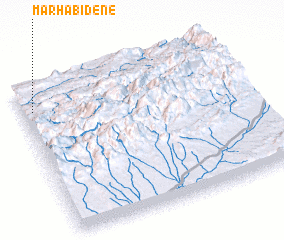 Places with similar names to Marhabidene, Morocco :: Disclaimer :: Information on this page comes without warranty of any kind |
||
|
Where is Marhabidene? Elevation and coordinates ::
Latitude (lat): 31°50'0"N Longitude (lon): 6°57'0"W
Elevation (approx.): 814m (map arrows pan, magnifying glasses zoom) |
||
|
Visiting Marhabidene? Hotel/Accommodation ::
Book a hotel in Marhabidene Travel Guide ::
Buy a travel guide for Morocco rental cars ::
car rental offers GPS waypoint ::
download a GPX waypoint (PoI) of Marhabidene for your GPS receiver
|
||