|
search place name
|
||
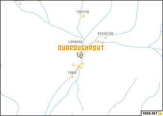
Ouaroughrout (Tata, Morocco)Ouaroughrout is a town in the Tata region of Morocco. An overview map of the region around Ouaroughrout is displayed below.
regional and 3d topo map of Ouaroughrout, Morocco ::
Ouaroughrout airports ::
The nearest airport is OZZ - Ouarzazate, located 93.0 km north of Ouaroughrout.
Other airports nearby include RAK - Marrakech Menara (200.5 km north west), Nearby towns ::
Foum Zguid (1.1km south) //
Ouayrtout (1.3km north) //
Bou Dellal (2.0km south) //
Foum Lhanch (2.1km south) //
Amzrou (2.0km north east) //
Tamzaourout (2.3km south west) //
Bou Guir (2.8km south) //
Lamhamid (3.1km north west) //
Bou Kdir (3.1km north east) //
Laghouanem (3.6km north east) //
Tabia (4.7km south west) //
Oulad Jama (5.0km north east) //
El Mahroug (5.5km north east) //
Es Smeyra (6.7km north east) //
[all distances 'as the bird flies' and approximate]  Places with similar names to Ouaroughrout, Morocco ::
// Orferode (DE)
// Orford (US)
// Ouro Verde (BR)
// Ouro Verde (BR)
// Orford (AU)
// Orford (AU)
// Orford (GB)
// Oro Verde (AR)
// Ouro Verde (BR)
// Ouro Verde (BR)
Disclaimer :: Information on this page comes without warranty of any kind |
||
|
Where is Ouaroughrout? Elevation and coordinates ::
Latitude (lat): 30°6'1"N Longitude (lon): 6°52'33"W
Elevation (approx.): 652m (map arrows pan, magnifying glasses zoom) |
||
|
Visiting Ouaroughrout? Hotel/Accommodation ::
Book a hotel in Ouaroughrout Travel Guide ::
Buy a travel guide for Morocco rental cars ::
car rental offers GPS waypoint ::
download a GPX waypoint (PoI) of Ouaroughrout for your GPS receiver
|
||