|
search place name
|
||
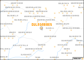
Oulad Abbes (Safi, Morocco)Oulad Abbes is a town in the Safi region of Morocco. An overview map of the region around Oulad Abbes is displayed below.
regional and 3d topo map of Oulad Abbes, Morocco ::
Oulad Abbes airports ::
The nearest airport is RAK - Marrakech Menara, located 55.9 km south east of Oulad Abbes.
Other airports nearby include CMN - Casablanca Mohammed V Intl (175.0 km north east), OZZ - Ouarzazate (185.5 km south east), AGA - Agadir Inezgane (204.5 km south west), Nearby towns ::
Jenarha (2.4km north east) //
El-Guelil (3.1km east) //
Douar Oulad Machou (4.0km north east) //
Douar Douibet (4.0km north west) //
Douar Msaada (4.9km south east) //
Douar Ouled Ben Azzouz (5.9km north west) //
Douar Bahira (7.4km north) //
Sedadma (7.4km south) //
Douar Hamada (7.6km north) //
Douar el Basda (6.6km west) //
Douar Cheïkh Allal Genadra (7.3km north east) //
Douar Hajj Ahmed (8.1km north west) //
Douar el Horch (8.8km north east) //
Lougramaf (8.8km north west) //
Oulad Saïd el Ahmar (8.8km south east) //
Douar Cheïk Ali Ben Chalah (8.4km north east) //
Oulad Moussa (10.0km north east) //
[all distances 'as the bird flies' and approximate]  Places with similar names to Oulad Abbes, Morocco ::
// Oulad Abbes (MA)
// Oulad Bissi (MA)
// Oulad Bouaouiss (MA)
// Oulad Bou Azza (MA)
// Oulad Bou Azza (MA)
// Oulad Abbes (MA)
// Oulad Bou Azza (MA)
// Oulad Bou Azza (MA)
// Oulad Bou Azi (MA)
// Oulad Boû ʼAzza (MA)
Disclaimer :: Information on this page comes without warranty of any kind |
||
|
Where is Oulad Abbes? Elevation and coordinates ::
Latitude (lat): 31°58'0"N Longitude (lon): 8°27'0"W
Elevation (approx.): 405m (map arrows pan, magnifying glasses zoom) |
||
|
Visiting Oulad Abbes? Hotel/Accommodation ::
Book a hotel in Oulad Abbes Travel Guide ::
Buy a travel guide for Morocco rental cars ::
car rental offers GPS waypoint ::
download a GPX waypoint (PoI) of Oulad Abbes for your GPS receiver
|
||