|
search place name
|
||
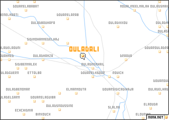
Oulad Ali (El Kelaa des Sraghna, Morocco)Oulad Ali is a town in the El Kelaa des Sraghna region of Morocco. An overview map of the region around Oulad Ali is displayed below.
regional and 3d topo map of Oulad Ali, Morocco ::
Oulad Ali airports ::
The nearest airport is RAK - Marrakech Menara, located 76.6 km south west of Oulad Ali.
Other airports nearby include OZZ - Ouarzazate (136.9 km south), CMN - Casablanca Mohammed V Intl (143.0 km north), RBA - Rabat Sale (227.8 km north), MEK - Meknes Bassatine (269.0 km north east), Nearby towns ::
Oulad Rerhail (2.4km south east) //
Douar el Ksour (4.0km south east) //
Oulad el Haj Ali (4.9km north west) //
El Kelaa des Srarhna (6.0km south east) //
El Marmouta (7.6km south) //
Rouich (7.3km south east) //
Ben Vella (8.8km south west) //
Douar el Assassel (9.7km south east) //
Douar Sidi Cadi Haja (9.7km south east) //
Oulad Ikkou (9.7km north east) //
[all distances 'as the bird flies' and approximate] 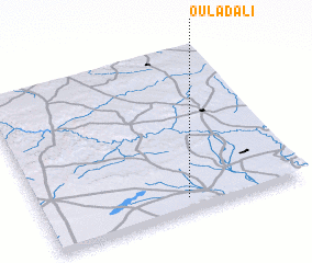 Places with similar names to Oulad Ali, Morocco ::
Disclaimer :: Information on this page comes without warranty of any kind |
||
|
Where is Oulad Ali? Elevation and coordinates ::
Latitude (lat): 32°5'0"N Longitude (lon): 7°27'0"W
Elevation (approx.): 441m (map arrows pan, magnifying glasses zoom) |
||
|
Visiting Oulad Ali? Hotel/Accommodation ::
Book a hotel in Oulad Ali Travel Guide ::
Buy a travel guide for Morocco rental cars ::
car rental offers GPS waypoint ::
download a GPX waypoint (PoI) of Oulad Ali for your GPS receiver
|
||