|
search place name
|
||
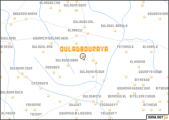
Oulad Bouraya (El Kelaa des Sraghna, Morocco)Oulad Bouraya is a town in the El Kelaa des Sraghna region of Morocco. An overview map of the region around Oulad Bouraya is displayed below.
regional and 3d topo map of Oulad Bouraya, Morocco ::
Oulad Bouraya airports ::
The nearest airport is RAK - Marrakech Menara, located 71.0 km west of Oulad Bouraya.
Other airports nearby include OZZ - Ouarzazate (101.3 km south), CMN - Casablanca Mohammed V Intl (177.5 km north), Nearby towns ::
Ksar Chaâra (1.6km east) //
Oulad Ouggad (2.2km east) //
Oulad Masbah (3.4km west) //
Oulad Mançour (4.0km south east) //
Douar Ben Aïcha (4.0km north west) //
Al Maaziz (5.8km north) //
Attaouiya ech Chaïbiya (6.0km north) //
Zouiat Taglaout (5.8km south east) //
Oulad Mosbah (6.0km south west) //
Oulad Ougal (7.4km north) //
Msouber (6.5km south west) //
Douar Caïd el Hachemi (7.3km north west) //
Oulad el Barkla (8.7km north east) //
Aït el Haj (9.7km south east) //
Sidi Bou Jemaa (9.7km south east) //
Oulad Chaoui (10.5km south west) //
[all distances 'as the bird flies' and approximate]  Places with similar names to Oulad Bouraya, Morocco :: Disclaimer :: Information on this page comes without warranty of any kind |
||
|
Where is Oulad Bouraya? Elevation and coordinates ::
Latitude (lat): 31°47'0"N Longitude (lon): 7°19'0"W
Elevation (approx.): 673m (map arrows pan, magnifying glasses zoom) |
||
|
Visiting Oulad Bouraya? Hotel/Accommodation ::
Book a hotel in Oulad Bouraya Travel Guide ::
Buy a travel guide for Morocco rental cars ::
car rental offers GPS waypoint ::
download a GPX waypoint (PoI) of Oulad Bouraya for your GPS receiver
|
||