|
search place name
|
||
Oulad Embarek (Er Rachidia, Morocco)Oulad Embarek is a town in the Er Rachidia region of Morocco. An overview map of the region around Oulad Embarek is displayed below.
regional and 3d topo map of Oulad Embarek, Morocco ::

Oulad Embarek airports ::
The nearest airport is ERH - Er-rachidia Moulay Ali Cherif, located 56.6 km north of Oulad Embarek.
Nearby towns ::
Ksakis (1.2km south east) //
Rezikat (1.7km south west) //
Moulay Brahim (1.9km south) //
Oulad Okba (1.9km south) //
Oulad Abdenbi (1.6km east) //
Oulad Bhar (1.6km east) //
Irane (1.6km east) //
Oulad Bouziane (1.9km north) //
Chlalfa (1.9km north) //
Oulad Mâatallah (2.4km south east) //
Oulad Ali (2.4km south east) //
Oulad Mouloud (2.4km south east) //
Oulad Taleb (2.4km north east) //
El Haïn (2.4km north east) //
Habibat (2.8km east) //
Kasba Ben Lahseïn (3.7km south) //
Hassasna (3.9km south west) //
Erfoud (3.6km south east) //
El Khandek (4.3km south west) //
Rhihana (4.9km north east) //
Mherigia (5.1km east) //
El Khendek (5.8km south) //
El Mâadid (5.2km east) //
Oulad Hannabou (6.9km south west) //
Kraïr (6.8km west) //
[all distances 'as the bird flies' and approximate] 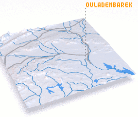 Places with similar names to Oulad Embarek, Morocco ::
// Oulad Embarek (MA)
// Oulad Mbarek (MA)
// Oulad Mbarek (MA)
// Oulad Mbarek (MA)
// Oulad Mbark (MA)
// Oulad Mbark (MA)
// Oulad Embarek (MA)
// Oulad Embarek (MA)
// Oulad Embarek (MA)
// Oulad Mbarek (MA)
Disclaimer :: Information on this page comes without warranty of any kind |
||
|
Where is Oulad Embarek? Elevation and coordinates ::
Latitude (lat): 31°27'0"N Longitude (lon): 4°16'0"W
Elevation (approx.): 802m (map arrows pan, magnifying glasses zoom) |
||
|
Visiting Oulad Embarek? Hotel/Accommodation ::
Book a hotel in Oulad Embarek Travel Guide ::
Buy a travel guide for Morocco rental cars ::
car rental offers GPS waypoint ::
download a GPX waypoint (PoI) of Oulad Embarek for your GPS receiver
|
||