|
search place name
|
||
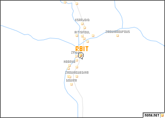
Rbit (Er Rachidia, Morocco)Rbit is a town in the Er Rachidia region of Morocco. An overview map of the region around Rbit is displayed below.
regional and 3d topo map of Rbit, Morocco ::
Rbit airports ::
The nearest airport is ERH - Er-rachidia Moulay Ali Cherif, located 38.3 km north west of Rbit.
Nearby towns ::
Tamarhakit (1.2km west) //
Zrigat (1.3km north west) //
Blarhma (2.2km south west) //
Maarka (2.9km south west) //
Sidi Ali el Goumi (3.5km south west) //
Aoufous (4.1km north) //
Zaouia Guedima (4.2km south) //
Oulad Amira (4.6km north) //
Zaouia Jedida (4.7km south west) //
El Betatha (4.8km south west) //
Aït Isfoul (5.2km north) //
Aoûtouss (5.4km north) //
Aït Khebbach (5.6km north) //
Douira (6.1km south) //
El Gara (7.1km north) //
Ksar Jdid (8.0km north) //
Zaouia Aoufous (8.6km north east) //
[all distances 'as the bird flies' and approximate] 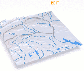 Places with similar names to Rbit, Morocco ::
Disclaimer :: Information on this page comes without warranty of any kind |
||
|
Where is Rbit? Elevation and coordinates ::
Latitude (lat): 31°39'10"N Longitude (lon): 4°11'17"W
Elevation (approx.): 882m (map arrows pan, magnifying glasses zoom) |
||
|
Visiting Rbit? Hotel/Accommodation ::
Book a hotel in Rbit Travel Guide ::
Buy a travel guide for Morocco rental cars ::
car rental offers GPS waypoint ::
download a GPX waypoint (PoI) of Rbit for your GPS receiver
|
||