|
search place name
|
||
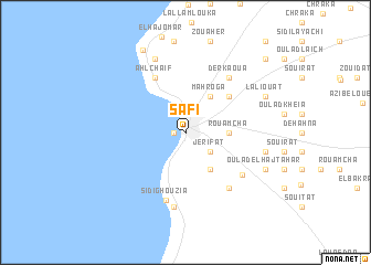
Safi (Safi, Morocco)Safi is a town in the Safi region of Morocco. An overview map of the region around Safi is displayed below.
regional and 3d topo map of Safi, Morocco ::
Safi airports ::
The nearest airport is RAK - Marrakech Menara, located 137.2 km south east of Safi.
Other airports nearby include CMN - Casablanca Mohammed V Intl (194.5 km north east), AGA - Agadir Inezgane (214.7 km south), Nearby towns ::
Medina (1.1km west) //
Mellah (1.1km west) //
Rbat (1.1km west) //
Douar Debra (2.1km north) //
Jerifat (2.8km south east) //
Rouamcha (3.6km east) //
Laoufat (4.2km south east) //
Mahroga (4.2km north east) //
Jebarat (4.2km north east) //
El Brenga (5.2km north east) //
Ahl Chaïf (6.2km north west) //
Doukkala (6.6km south east) //
Derkaoua (6.6km north east) //
Sidi Ghouzia (7.0km south) //
Oulad Ahmed Ben Ali (6.4km south east) //
El Hamri (7.5km south) //
Diabet (7.9km north) //
Bella (7.0km east) //
Oulad el Haj Tahar (7.7km south east) //
Lemrhouar (7.7km south east) //
Laliouat (7.7km north east) //
Iterkine (9.2km north west) //
Karouch (10.0km north east) //
[all distances 'as the bird flies' and approximate] 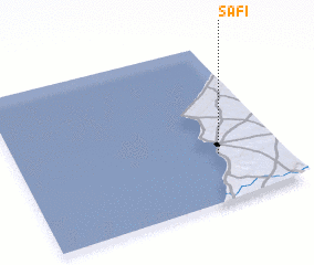 Places with similar names to Safi, Morocco ::
Disclaimer :: Information on this page comes without warranty of any kind |
||
|
Where is Safi? Elevation and coordinates ::
Latitude (lat): 32°18'0"N Longitude (lon): 9°14'19"W
Elevation (approx.): 21m (map arrows pan, magnifying glasses zoom) |
||
|
Visiting Safi? Hotel/Accommodation ::
Book a hotel in Safi Travel Guide ::
Buy a travel guide for Morocco rental cars ::
car rental offers GPS waypoint ::
download a GPX waypoint (PoI) of Safi for your GPS receiver
|
||