|
search place name
|
||
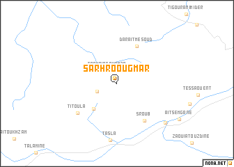
Sarhro Ougmar (Ouarzazate, Morocco)Sarhro Ougmar is a town in the Ouarzazate region of Morocco. An overview map of the region around Sarhro Ougmar is displayed below.
regional and 3d topo map of Sarhro Ougmar, Morocco ::
Sarhro Ougmar airports ::
The nearest airport is OZZ - Ouarzazate, located 35.5 km north west of Sarhro Ougmar.
Other airports nearby include RAK - Marrakech Menara (162.2 km north west), Nearby towns ::
Taourirt nʼHamza (2.4km north west) //
Tafraout nʼOufella (3.0km south west) //
Imider (5.2km south west) //
Dar Aït Mesoud (6.6km north east) //
Sroub (7.1km south east) //
Titoula (7.2km south west) //
Daou Tazegzat (9.2km south east) //
[all distances 'as the bird flies' and approximate] 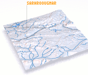 Places with similar names to Sarhro Ougmar, Morocco :: Disclaimer :: Information on this page comes without warranty of any kind |
||
|
Where is Sarhro Ougmar? Elevation and coordinates ::
Latitude (lat): 30°39'0"N Longitude (lon): 6°45'0"W
Elevation (approx.): 1690m (map arrows pan, magnifying glasses zoom) |
||
|
Visiting Sarhro Ougmar? Hotel/Accommodation ::
Book a hotel in Sarhro Ougmar Travel Guide ::
Buy a travel guide for Morocco rental cars ::
car rental offers GPS waypoint ::
download a GPX waypoint (PoI) of Sarhro Ougmar for your GPS receiver
|
||