|
search place name
|
||
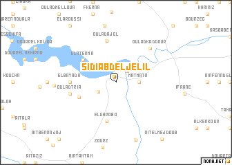
Sidi Abd el Jelil (Fès, Morocco)Sidi Abd el Jelil is a town in the Fès region of Morocco. An overview map of the region around Sidi Abd el Jelil is displayed below.
regional and 3d topo map of Sidi Abd el Jelil, Morocco ::
Sidi Abd el Jelil airports ::
The nearest airport is FEZ - Fez Saiss, located 41.2 km south west of Sidi Abd el Jelil.
Other airports nearby include MEK - Meknes Bassatine (89.5 km west), AHU - Al Hociema Cherif El Idrissi (137.6 km north east), TTU - Tetouan Saniat Rmel (178.9 km north), MLN - Melilla (198.4 km north east), Nearby towns ::
Oulad Raho (2.4km north east) //
Oulad Aiyad (2.8km south west) //
Matmata (3.1km east) //
El Aterma (5.7km north west) //
El Ghraba (5.5km south west) //
El Ghraba (6.4km south) //
Oulad Ajel (6.9km north) //
El Bayada (6.1km west) //
Oulad Tria (6.4km west) //
Douar Khifat (7.2km north east) //
Oulad Kaddour (7.2km north east) //
[all distances 'as the bird flies' and approximate]  Places with similar names to Sidi Abd el Jelil, Morocco :: Disclaimer :: Information on this page comes without warranty of any kind |
||
|
Where is Sidi Abd el Jelil? Elevation and coordinates ::
Latitude (lat): 34°6'0"N Longitude (lon): 4°35'0"W
Elevation (approx.): 285m (map arrows pan, magnifying glasses zoom) |
||
|
Visiting Sidi Abd el Jelil? Hotel/Accommodation ::
Book a hotel in Sidi Abd el Jelil Travel Guide ::
Buy a travel guide for Morocco rental cars ::
car rental offers GPS waypoint ::
download a GPX waypoint (PoI) of Sidi Abd el Jelil for your GPS receiver
|
||