|
search place name
|
||
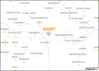
Smihat (El Kelaa des Sraghna, Morocco)Smihat is a town in the El Kelaa des Sraghna region of Morocco. An overview map of the region around Smihat is displayed below.
regional and 3d topo map of Smihat, Morocco ::
Smihat airports ::
The nearest airport is RAK - Marrakech Menara, located 70.1 km south of Smihat.
Other airports nearby include CMN - Casablanca Mohammed V Intl (135.7 km north), OZZ - Ouarzazate (184.6 km south east), RBA - Rabat Sale (239.3 km north east), AGA - Agadir Inezgane (245.5 km south west), Nearby towns ::
Oulad Sidi Abd el Krim (2.1km west) //
El Aouinet (4.0km south) //
Tadla (4.9km north west) //
Ouled Bell (4.7km west) //
Soualah Ben Hamadi (4.9km east) //
Ouled Barbouchia (6.4km north west) //
Oulad Hoummed (6.2km west) //
Douar Soualah el Hasser (6.5km east) //
Haj Bou Jema (8.8km south west) //
Sidi Allali (8.3km north west) //
El Maallemine (9.6km north west) //
Es Sebt de Brikiine (9.7km north east) //
[all distances 'as the bird flies' and approximate]  Places with similar names to Smihat, Morocco ::
Disclaimer :: Information on this page comes without warranty of any kind |
||
|
Where is Smihat? Elevation and coordinates ::
Latitude (lat): 32°14'0"N Longitude (lon): 8°8'0"W
Elevation (approx.): 396m (map arrows pan, magnifying glasses zoom) |
||
|
Visiting Smihat? Hotel/Accommodation ::
Book a hotel in Smihat Travel Guide ::
Buy a travel guide for Morocco rental cars ::
car rental offers GPS waypoint ::
download a GPX waypoint (PoI) of Smihat for your GPS receiver
|
||