|
search place name
|
||
Tagnit NʼIsli (Marrakech, Morocco)Tagnit NʼIsli is a town in the Marrakech region of Morocco. An overview map of the region around Tagnit NʼIsli is displayed below.
regional and 3d topo map of Tagnit NʼIsli, Morocco ::

Tagnit NʼIsli airports ::
The nearest airport is RAK - Marrakech Menara, located 64.1 km west of Tagnit NʼIsli.
Other airports nearby include OZZ - Ouarzazate (79.0 km south east), CMN - Casablanca Mohammed V Intl (204.5 km north), Nearby towns ::
Tissert (1.6km west) //
Aït el Rhazi (1.9km north) //
Alane (2.2km south) //
Bou Imzgane (2.4km north east) //
Imzilene (3.4km north) //
Toukart Nouzgou (4.0km north east) //
Tisklafine (3.7km north east) //
Chouka (4.6km north east) //
Ouaouizakht (4.9km south west) //
Tassilit Ourso (5.8km south) //
Talmest (5.4km south west) //
Aghbalou (6.3km south west) //
Aït Idar (6.4km south east) //
Toumzaïne (6.6km west) //
Timert (7.6km north) //
Ichmarahane (7.6km north) //
Aït Ben Taleb (6.6km east) //
Souq al Arab (7.3km north east) //
Adouz (7.3km north west) //
Abadou (7.3km north east) //
Aït Tarzout (7.3km south west) //
Sidi Taïeb (7.3km north west) //
Anzel (7.3km north west) //
Ikouzoudane (8.0km south east) //
Aït Hammad (7.5km west) //
Imizar (8.4km north west) //
Lagh (10.0km north west) //
[all distances 'as the bird flies' and approximate] 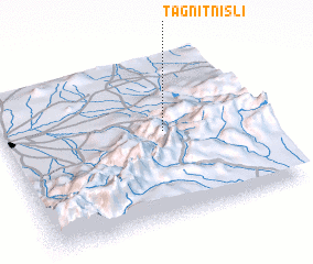 Places with similar names to Tagnit NʼIsli, Morocco :: Disclaimer :: Information on this page comes without warranty of any kind |
||
|
Where is Tagnit NʼIsli? Elevation and coordinates ::
Latitude (lat): 31°32'0"N Longitude (lon): 7°22'0"W
Elevation (approx.): 1408m (map arrows pan, magnifying glasses zoom) |
||
|
Visiting Tagnit NʼIsli? Hotel/Accommodation ::
Book a hotel in Tagnit NʼIsli Travel Guide ::
Buy a travel guide for Morocco rental cars ::
car rental offers GPS waypoint ::
download a GPX waypoint (PoI) of Tagnit NʼIsli for your GPS receiver
|
||