|
search place name
|
||
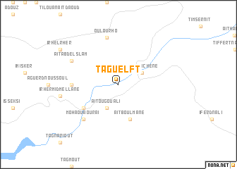
Taguelft (Azilal, Morocco)Taguelft is a town in the Azilal region of Morocco. An overview map of the region around Taguelft is displayed below.
regional and 3d topo map of Taguelft, Morocco ::
Taguelft airports ::
The nearest airport is OZZ - Ouarzazate, located 163.0 km south west of Taguelft.
Other airports nearby include ERH - Er-rachidia Moulay Ali Cherif (167.2 km east), CMN - Casablanca Mohammed V Intl (184.3 km north west), MEK - Meknes Bassatine (189.7 km north), RAK - Marrakech Menara (193.6 km west), Nearby towns ::
Aït Ououchene (3.6km north east) //
Aït Ou Gouali (4.0km south west) //
Aït Boulmane (5.8km south) //
Arhembou (6.0km south west) //
Irherm Ou Assif (6.0km south west) //
Ladi nʼOugouram (6.3km west) //
Oulourho (7.6km north) //
Moha ou Aourai (7.3km south west) //
Aït Abd el Slam (7.3km north west) //
[all distances 'as the bird flies' and approximate] 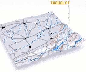
Disclaimer :: Information on this page comes without warranty of any kind |
||
|
Where is Taguelft? Elevation and coordinates ::
Latitude (lat): 32°15'0"N Longitude (lon): 6°8'0"W
Elevation (approx.): 999m (map arrows pan, magnifying glasses zoom) |
||
|
Visiting Taguelft? Hotel/Accommodation ::
Book a hotel in Taguelft Travel Guide ::
Buy a travel guide for Morocco rental cars ::
car rental offers GPS waypoint ::
download a GPX waypoint (PoI) of Taguelft for your GPS receiver
|
||