|
search place name
|
||
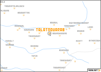
Talat nʼOu Arab (Khenifra, Morocco)Talat nʼOu Arab is a town in the Khenifra region of Morocco. An overview map of the region around Talat nʼOu Arab is displayed below.
regional and 3d topo map of Talat nʼOu Arab, Morocco ::
Talat nʼOu Arab airports ::
The nearest airport is ERH - Er-rachidia Moulay Ali Cherif, located 112.5 km south east of Talat nʼOu Arab.
Other airports nearby include MEK - Meknes Bassatine (166.9 km north), FEZ - Fez Saiss (178.4 km north), OZZ - Ouarzazate (209.1 km south west), RBA - Rabat Sale (220.5 km north west), Nearby towns ::
Bou Irghissene (2.9km east) //
Bou Adil (3.6km north west) //
Izzi Athmane (3.6km west) //
Bou Adil (4.3km north) //
Takerdoust (5.1km west) //
Tihandar (5.5km north east) //
Akkaïou (6.8km south west) //
Tamefrast (6.6km north east) //
Igourdane (6.8km west) //
Agheddou (7.6km south east) //
Tefza (9.7km south west) //
[all distances 'as the bird flies' and approximate] 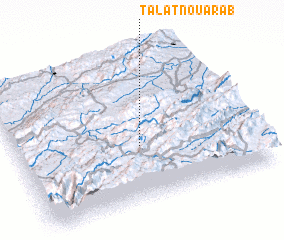 Places with similar names to Talat nʼOu Arab, Morocco :: Disclaimer :: Information on this page comes without warranty of any kind |
||
|
Where is Talat nʼOu Arab? Elevation and coordinates ::
Latitude (lat): 32°22'29"N Longitude (lon): 5°28'47"W
Elevation (approx.): 1766m (map arrows pan, magnifying glasses zoom) |
||
|
Visiting Talat nʼOu Arab? Hotel/Accommodation ::
Book a hotel in Talat nʼOu Arab Travel Guide ::
Buy a travel guide for Morocco rental cars ::
car rental offers GPS waypoint ::
download a GPX waypoint (PoI) of Talat nʼOu Arab for your GPS receiver
|
||