|
search place name
|
||
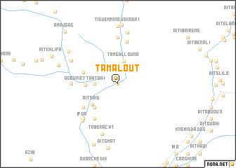
Tamalout (Ouarzazate, Morocco)Tamalout is a town in the Ouarzazate region of Morocco. An overview map of the region around Tamalout is displayed below.
regional and 3d topo map of Tamalout, Morocco ::
Tamalout airports ::
The nearest airport is OZZ - Ouarzazate, located 88.9 km south west of Tamalout.
Other airports nearby include ERH - Er-rachidia Moulay Ali Cherif (176.0 km east), RAK - Marrakech Menara (182.5 km west), CMN - Casablanca Mohammed V Intl (259.2 km north west), Nearby towns ::
Bou Drarar (0.0km north) //
Tameskikt (3.2km west) //
Tamgallouna (3.8km north) //
Aït Saïd (4.7km south west) //
Agouni et Tahtani (4.5km west) //
Taziricht (4.9km south west) //
Talemdout (5.1km west) //
Tourbist (6.0km south west) //
Hadida (6.4km south west) //
Tisguine nʼAït MʼRao (6.9km north) //
Aït Ouska Issoumer (7.4km north) //
Igouramene nʼImi nʼOuska (7.4km north) //
Agouti el Foukani (6.3km west) //
Iberkhoussene (7.3km south west) //
‘Ifur (7.6km south west) //
Ifer (7.3km north west) //
Tirhemt nʼOugogene (7.3km north west) //
Igherm Akkim (8.3km north) //
Taberacht (8.3km south) //
Alemdoun (8.5km north west) //
Amajgag (11.0km north west) //
[all distances 'as the bird flies' and approximate]  Places with similar names to Tamalout, Morocco ::
Disclaimer :: Information on this page comes without warranty of any kind |
||
|
Where is Tamalout? Elevation and coordinates ::
Latitude (lat): 31°23'0"N Longitude (lon): 6°8'0"W
Elevation (approx.): 1595m (map arrows pan, magnifying glasses zoom) |
||
|
Visiting Tamalout? Hotel/Accommodation ::
Book a hotel in Tamalout Travel Guide ::
Buy a travel guide for Morocco rental cars ::
car rental offers GPS waypoint ::
download a GPX waypoint (PoI) of Tamalout for your GPS receiver
|
||