|
search place name
|
||
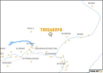
Tanguerfa (Ouarzazate, Morocco)Tanguerfa is a town in the Ouarzazate region of Morocco. An overview map of the region around Tanguerfa is displayed below.
regional and 3d topo map of Tanguerfa, Morocco ::
Tanguerfa airports ::
The nearest airport is OZZ - Ouarzazate, located 72.6 km west of Tanguerfa.
Other airports nearby include RAK - Marrakech Menara (200.6 km north west), ERH - Er-rachidia Moulay Ali Cherif (215.6 km north east), Nearby towns ::
Aït Ben Ouazer (4.8km south east) //
Aït Basso (4.8km east) //
Zaouia nʼIkhef nʼOuzrou (5.8km south) //
Ichehihane (5.6km east) //
Aït Idir (6.0km south west) //
Tansikht (7.3km south) //
Aït Oudinar (7.4km south) //
Tafelt (6.6km west) //
Tatelt (6.6km west) //
Aït Melk (7.3km south west) //
Aït Hammou (7.9km south east) //
Aït Shak (7.4km south west) //
Ouaouzagour (8.3km south) //
Izmaoun (8.5km south west) //
Aït Issi (8.5km south west) //
Aïra nʼAït Sedrat (8.4km south west) //
Tamkasselt (9.8km south west) //
[all distances 'as the bird flies' and approximate]  Places with similar names to Tanguerfa, Morocco ::
// Tinguerf (MA)
// Tongarivo (MG)
// Tongarivo (MG)
// Tinney Grove (US)
// Tunga Rafi (NG)
// Dungriff (US)
Disclaimer :: Information on this page comes without warranty of any kind |
||
|
Where is Tanguerfa? Elevation and coordinates ::
Latitude (lat): 30°45'0"N Longitude (lon): 6°11'0"W
Elevation (approx.): 988m (map arrows pan, magnifying glasses zoom) |
||
|
Visiting Tanguerfa? Hotel/Accommodation ::
Book a hotel in Tanguerfa Travel Guide ::
Buy a travel guide for Morocco rental cars ::
car rental offers GPS waypoint ::
download a GPX waypoint (PoI) of Tanguerfa for your GPS receiver
|
||