|
search place name
|
||
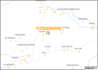
Tizougaghine (Er Rachidia, Morocco)Tizougaghine is a town in the Er Rachidia region of Morocco. An overview map of the region around Tizougaghine is displayed below.
regional and 3d topo map of Tizougaghine, Morocco ::
Tizougaghine airports ::
The nearest airport is ERH - Er-rachidia Moulay Ali Cherif, located 64.8 km north east of Tizougaghine.
Other airports nearby include OZZ - Ouarzazate (200.5 km west), Nearby towns ::
Aït Ba Maati (1.2km west) //
Aït Mav (2.0km west) //
El Mamoun (2.6km south west) //
El Khtart nʼOughroud (4.0km north east) //
Tiguida (4.2km east) //
El Guelta (4.8km east) //
Chtem (5.6km south) //
Igli (7.3km south east) //
Isilf (8.0km south) //
Tamellalt (7.7km south east) //
Moul Hiya (8.9km north) //
Tiaouanine (8.9km north) //
Mertoucha (8.2km south east) //
Bou Tounfit (9.0km north) //
Khlil (8.8km north east) //
Khlil (9.1km north) //
Aït Faska (9.1km north) //
Ksiba nʼIgouramene (8.8km south west) //
Iournza (9.5km north east) //
Zaouia el Haouari (10.0km south west) //
Ksar Kta el Oued (10.5km south west) //
Aït Mameur Oujedid (10.7km south west) //
Aït Sidi Moussa Ou Assou (10.9km north east) //
[all distances 'as the bird flies' and approximate] 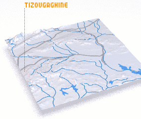 Places with similar names to Tizougaghine, Morocco ::
Disclaimer :: Information on this page comes without warranty of any kind |
||
|
Where is Tizougaghine? Elevation and coordinates ::
Latitude (lat): 31°36'15"N Longitude (lon): 4°57'5"W
Elevation (approx.): 988m (map arrows pan, magnifying glasses zoom) |
||
|
Visiting Tizougaghine? Hotel/Accommodation ::
Book a hotel in Tizougaghine Travel Guide ::
Buy a travel guide for Morocco rental cars ::
car rental offers GPS waypoint ::
download a GPX waypoint (PoI) of Tizougaghine for your GPS receiver
|
||