|
search place name
|
||
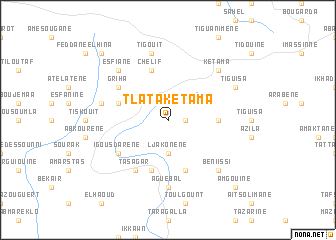
Tlata Ketama (Al Hoceïma, Morocco)Tlata Ketama is a town in the Al Hoceïma region of Morocco. An overview map of the region around Tlata Ketama is displayed below.
regional and 3d topo map of Tlata Ketama, Morocco ::
Tlata Ketama airports ::
The nearest airport is AHU - Al Hociema Cherif El Idrissi, located 78.8 km north east of Tlata Ketama.
Other airports nearby include TTU - Tetouan Saniat Rmel (103.0 km north west), FEZ - Fez Saiss (109.4 km south), MEK - Meknes Bassatine (137.2 km south west), TNG - Tanger Ibn Batouta (152.0 km north west), Nearby towns ::
Esgara (1.5km east) //
Et Tleta des Ketama (2.4km north west) //
Ljakonene (3.7km south) //
Tasagratz (4.6km east) //
Chelif (5.8km north) //
Tameloughit (4.9km west) //
Achorot Mensor (5.8km south) //
Al Makhzene (5.8km south) //
Griha (5.9km north west) //
Tasagar (6.3km south west) //
Igousdarene (5.9km south west) //
Aguebal (7.4km south) //
Tigouit (7.6km north) //
Asagar (6.4km west) //
Ketama (7.2km north east) //
Esfiane (7.2km north west) //
Beni Issi (7.2km south east) //
Tiguisa (7.1km north east) //
Beni Bechir (9.6km north west) //
Amgouine (9.6km south east) //
[all distances 'as the bird flies' and approximate]  Places with similar names to Tlata Ketama, Morocco :: Disclaimer :: Information on this page comes without warranty of any kind |
||
|
Where is Tlata Ketama? Elevation and coordinates ::
Latitude (lat): 34°52'0"N Longitude (lon): 4°37'0"W
Elevation (approx.): 1347m (map arrows pan, magnifying glasses zoom) |
||
|
Visiting Tlata Ketama? Hotel/Accommodation ::
Book a hotel in Tlata Ketama Travel Guide ::
Buy a travel guide for Morocco rental cars ::
car rental offers GPS waypoint ::
download a GPX waypoint (PoI) of Tlata Ketama for your GPS receiver
|
||