|
search place name
|
||
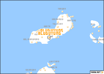
Aluduyung (Sulu, Philippines)Aluduyung is a town in the Sulu region of Philippines. An overview map of the region around Aluduyung is displayed below.
regional and 3d topo map of Aluduyung, Philippines ::
Aluduyung airports ::
The nearest airport is ZAM - Zamboanga Intl, located 190.3 km north east of Aluduyung.
Nearby towns ::
Alu Duyung (1.3km south west) //
Aludapdap (1.4km east) //
Gapas (1.9km north east) //
Pait (2.0km north) //
Lagonding (2.2km east) //
Kalookan (2.4km north east) //
Tapul (3.0km north east) //
Manta (3.3km north west) //
Tompong (3.4km north east) //
Kuta” Parang (3.7km west) //
Tabu Kalang (4.1km north east) //
Larap (4.1km north west) //
Tulin Can (4.3km north east) //
Bas (4.8km north west) //
Huit-Huit (5.3km north west) //
Lugus (5.6km north west) //
Parian Laha (5.8km west) //
Nuitnuit (5.8km west) //
Kamaunggi (5.9km north) //
Kanaway (6.3km east) //
Laum Patong (6.7km north east) //
Pangdan (6.7km north east) //
Kan Asal (6.7km north east) //
Tingcanan (7.2km west) //
Pangpang (7.5km north east) //
Bolipongpong (7.5km west) //
Pagatpat (8.0km north east) //
Buhagnanapan (8.3km north east) //
Tagadpat (8.3km north east) //
[all distances 'as the bird flies' and approximate] 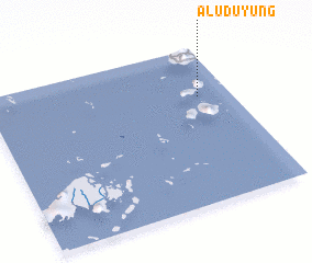 Places with similar names to Aluduyung, Philippines ::
// Alu Duyung (PH)
// Aloutoyiannaíika (GR)
Disclaimer :: Information on this page comes without warranty of any kind |
||
|
Where is Aluduyung? Elevation and coordinates ::
Latitude (lat): 5°41'0"N Longitude (lon): 120°52'0"E
Elevation (approx.): 28m (map arrows pan, magnifying glasses zoom) |
||
|
Visiting Aluduyung? Hotel/Accommodation ::
Book a hotel in Aluduyung Travel Guide ::
Buy a travel guide for Philippines rental cars ::
car rental offers GPS waypoint ::
download a GPX waypoint (PoI) of Aluduyung for your GPS receiver
|
||