|
search place name
|
||
Ambangonan (La Union, Philippines)Ambangonan is a town in the La Union region of Philippines. An overview map of the region around Ambangonan is displayed below.
regional and 3d topo map of Ambangonan, Philippines ::

Ambangonan airports ::
The nearest airport is BAG - Baguio, located 17.7 km north east of Ambangonan.
Other airports nearby include MNL - Manila Ninoy Aquino Intl (205.5 km south), Nearby towns ::
Dagupan (0.9km south east) //
Maoasoas (0.9km south east) //
Garampang (0.9km south east) //
Ambangonan (1.1km north) //
Carunoan (1.8km south) //
Ambalite (1.8km north west) //
San Luis (2.7km south) //
Inabaan (3.2km south) //
Tavora (3.2km north west) //
Tabaan (4.1km east) //
Casilagan (4.5km south) //
Cuenca (4.7km south) //
Taloy (5.3km north east) //
Palina (5.7km north west) //
Tanglag (6.5km south) //
Saytan (6.5km south east) //
Rosario (6.6km south) //
Mangitkiran (6.4km north east) //
Amlang (6.7km south west) //
Agat (7.3km south east) //
Dongon (7.5km south east) //
Verceles (7.3km north west) //
Anduyan (7.6km north west) //
Camp One (7.7km south) //
Udiao (7.8km south) //
Concepcion (8.3km south) //
Subusub (8.5km south) //
San Pascual (8.5km north) //
San Pascual (8.4km north west) //
[all distances 'as the bird flies' and approximate] 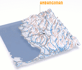 Places with similar names to Ambangonan, Philippines ::
// Ambangonan (PH)
Disclaimer :: Information on this page comes without warranty of any kind |
||
|
Where is Ambangonan? Elevation and coordinates ::
Latitude (lat): 16°17'25"N Longitude (lon): 120°28'47"E
Elevation (approx.): 121m (map arrows pan, magnifying glasses zoom) |
||
|
Visiting Ambangonan? Hotel/Accommodation ::
Book a hotel in Ambangonan Travel Guide ::
Buy a travel guide for Philippines rental cars ::
car rental offers GPS waypoint ::
download a GPX waypoint (PoI) of Ambangonan for your GPS receiver
|
||