|
search place name
|
||
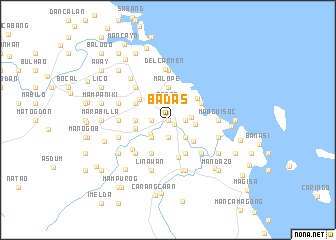
Badas (Camarines Norte, Philippines)Badas is a town in the Camarines Norte region of Philippines. An overview map of the region around Badas is displayed below.
regional and 3d topo map of Badas, Philippines ::
Badas airports ::
The nearest airport is MNL - Manila Ninoy Aquino Intl, located 212.7 km west of Badas.
Nearby towns ::
Daculangbolo (0.0km north) //
Langa (0.0km north) //
Mantagbac (0.0km north) //
Lagon (0.0km north) //
Daet (0.8km south east) //
Gahonon (1.9km north) //
Gatbo (1.9km north) //
Tabataba (1.9km north) //
Manbiga (1.9km south) //
Mancruz (1.9km south) //
Pasig (1.9km south) //
Carumpit (1.8km east) //
Danao (1.8km west) //
Angit (1.8km east) //
Bakhaw (1.8km east) //
Calawihao (1.8km west) //
Camambugan (2.5km south west) //
Tabyogen (2.5km east) //
Lipata (2.6km north east) //
Binorocbasocan (2.6km north west) //
Manlubang (2.6km south east) //
Magang (2.6km south west) //
Mambaliti (2.6km south east) //
Manbalete (2.6km south east) //
Libjo (2.6km south east) //
Mantanguid (2.6km south west) //
Padaguit (2.6km south west) //
Gubat (3.0km east) //
Bactas (3.6km south east) //
[all distances 'as the bird flies' and approximate] 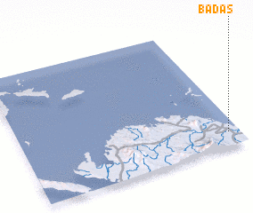 Places with similar names to Badas, Philippines ::
Disclaimer :: Information on this page comes without warranty of any kind |
||
|
Where is Badas? Elevation and coordinates ::
Latitude (lat): 14°7'0"N Longitude (lon): 122°57'0"E
Elevation (approx.): 11m (map arrows pan, magnifying glasses zoom) |
||
|
Visiting Badas? Hotel/Accommodation ::
Book a hotel in Badas Travel Guide ::
Buy a travel guide for Philippines rental cars ::
car rental offers GPS waypoint ::
download a GPX waypoint (PoI) of Badas for your GPS receiver
|
||