|
search place name
|
||
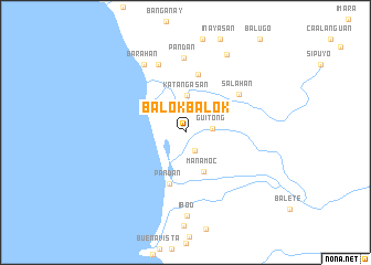
Balokbalok (Mindoro Oriental, Philippines)Balokbalok is a town in the Mindoro Oriental region of Philippines. An overview map of the region around Balokbalok is displayed below.
regional and 3d topo map of Balokbalok, Philippines ::
Balokbalok airports ::
The nearest airport is MNL - Manila Ninoy Aquino Intl, located 174.2 km north of Balokbalok.
Other airports nearby include KLO - Kalibo (221.5 km south east), Nearby towns ::
Consuya (2.1km south east) //
Guitong (2.7km east) //
Katangasan (3.7km north) //
Manamoc (4.3km south east) //
Pandan (5.4km south) //
Makati (5.9km north) //
Salahan (6.5km north east) //
Palanipan (7.3km north) //
Pandan (7.6km north) //
Barahan (8.0km north west) //
Ibod (8.4km south) //
Balatican (8.8km north east) //
[all distances 'as the bird flies' and approximate] 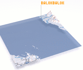 Places with similar names to Balokbalok, Philippines ::
// Balacbalac (PH)
// Balacbalac (PH)
// Balicbalic (PH)
// Balocbaloc (PH)
// Balogblog (PH)
// Bilog-Bilog (PH)
// Bolocboloc (PH)
// Bolocboloc (PH)
// Bolocboloc (PH)
// Buluk Buluk (NG)
Disclaimer :: Information on this page comes without warranty of any kind |
||
|
Where is Balokbalok? Elevation and coordinates ::
Latitude (lat): 12°56'55"N Longitude (lon): 120°48'5"E
Elevation (approx.): 7m (map arrows pan, magnifying glasses zoom) |
||
|
Visiting Balokbalok? Hotel/Accommodation ::
Book a hotel in Balokbalok Travel Guide ::
Buy a travel guide for Philippines rental cars ::
car rental offers GPS waypoint ::
download a GPX waypoint (PoI) of Balokbalok for your GPS receiver
|
||