|
search place name
|
||
Banasi (Pangasinan, Philippines)Banasi is a town in the Pangasinan region of Philippines. An overview map of the region around Banasi is displayed below.
regional and 3d topo map of Banasi, Philippines ::

Banasi airports ::
The nearest airport is BAG - Baguio, located 63.8 km north of Banasi.
Other airports nearby include MNL - Manila Ninoy Aquino Intl (160.3 km south east), Nearby towns ::
Banaban (0.0km north) //
Tococ East (0.0km north) //
Cais (1.9km south) //
Sapang (1.8km east) //
Alige (1.8km east) //
Langiran (1.8km west) //
Patacbo (1.9km north) //
Banaban (2.6km south east) //
Bical (2.6km south east) //
Cambuca (2.6km south west) //
Talinorung (2.6km south west) //
Tanolong (2.6km south west) //
Obong (2.6km north west) //
Malimpec East (2.6km north west) //
Basista (2.9km north west) //
Asin (3.6km east) //
Malaca (3.6km west) //
Tambac (4.0km south east) //
Tubor (4.0km south east) //
Camp Gregg (4.0km south east) //
Burgos (4.0km south east) //
Bongato (4.0km south east) //
Nalsian Norte (4.0km north east) //
Bincaon (4.0km south west) //
Mabolitec (4.1km north east) //
Bulung (4.0km north west) //
Navatat (4.1km north west) //
Atainan (4.3km east) //
San Julian (4.8km north east) //
[all distances 'as the bird flies' and approximate] 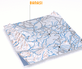 Places with similar names to Banasi, Philippines ::
Disclaimer :: Information on this page comes without warranty of any kind |
||
|
Where is Banasi? Elevation and coordinates ::
Latitude (lat): 15°50'0"N Longitude (lon): 120°25'0"E
Elevation (approx.): 13m (map arrows pan, magnifying glasses zoom) |
||
|
Visiting Banasi? Hotel/Accommodation ::
Book a hotel in Banasi Travel Guide ::
Buy a travel guide for Philippines rental cars ::
car rental offers GPS waypoint ::
download a GPX waypoint (PoI) of Banasi for your GPS receiver
|
||