|
search place name
|
||
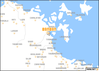
Banban (Surigao del Norte, Philippines)Banban is a town in the Surigao del Norte region of Philippines. An overview map of the region around Banban is displayed below.
regional and 3d topo map of Banban, Philippines ::
Banban airports ::
The nearest airport is CGY - Ladag Cagayan De Oro, located 177.4 km south west of Banban.
Other airports nearby include TAC - Tacloban Daniel Z Romualdez (181.1 km north), NOP - Masbate Mactan Cebu Intl (189.7 km west), Nearby towns ::
Tagana-an (1.3km north west) //
Cawilan (1.7km north west) //
Opong (2.5km north) //
Tinabingan (2.6km south) //
Placer (4.0km south) //
Amoslog (5.7km south) //
Lakandola (6.0km east) //
Libas (6.3km south west) //
Badas (6.7km south) //
Pahutongan (6.9km south) //
Bugas-Bugas (6.9km south west) //
Makalaya (7.7km south) //
Sison (7.7km south west) //
Capalayan (7.9km north west) //
Tagbongabong (8.0km south) //
Siwata (8.4km south) //
Punta (9.1km south east) //
Kinabutan (9.1km south east) //
Anislagan (9.5km south west) //
San Jose (11.1km north east) //
Kagniog (12.1km north west) //
Cagmug (12.1km north west) //
[all distances 'as the bird flies' and approximate] 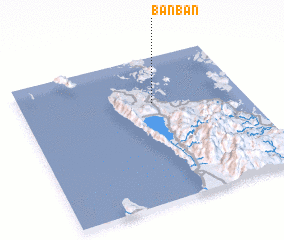 Places with similar names to Banban, Philippines ::
// Banaban (PH)
// Banaban (PH)
// Banaban (PH)
// Banay-Banay (PH)
// Banaybanay (PH)
// Banaybanay (PH)
// Banaybanay (PH)
// Banaybanay (PH)
// Banaybanay (PH)
// Banban (PH)
Disclaimer :: Information on this page comes without warranty of any kind |
||
|
Where is Banban? Elevation and coordinates ::
Latitude (lat): 9°41'19"N Longitude (lon): 125°35'35"E
(map arrows pan, magnifying glasses zoom) |
||
|
Visiting Banban? Hotel/Accommodation ::
Book a hotel in Banban Travel Guide ::
Buy a travel guide for Philippines rental cars ::
car rental offers GPS waypoint ::
download a GPX waypoint (PoI) of Banban for your GPS receiver
|
||