|
search place name
|
||
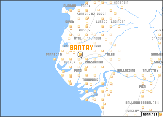
Bantay (Ilocos Sur, Philippines)Bantay is a town in the Ilocos Sur region of Philippines. An overview map of the region around Bantay is displayed below.
regional and 3d topo map of Bantay, Philippines ::
Bantay airports ::
The nearest airport is BAG - Baguio, located 136.1 km south of Bantay.
Nearby towns ::
Capangpangan (0.6km west) //
Anan-nam (0.6km west) //
Turod (0.6km west) //
Capangdanan (0.6km west) //
Baoay (0.6km west) //
Cabalangegan (0.6km west) //
Quimmarayan (0.6km west) //
Mira (0.6km west) //
Taguipuro (0.6km west) //
Bulag (0.6km west) //
San Julian (0.6km west) //
Guimod (0.6km west) //
Cuta (0.6km west) //
Puroc a Dacquel (0.6km west) //
Sal-lacong (0.6km west) //
Balaleng (0.6km west) //
Pantay Laud (0.6km west) //
Banaoang (0.6km west) //
Vigan (1.1km south) //
San Julian Norte (1.2km east) //
Cacaldingan (1.2km east) //
Buquig (1.2km east) //
Cabaroan (1.2km east) //
Aggay (1.2km east) //
Sagpat (1.8km north) //
Paoa (1.8km north) //
Cabaroan (1.8km north) //
Busiing Sur (1.8km north) //
Nalasin (1.8km north) //
[all distances 'as the bird flies' and approximate] 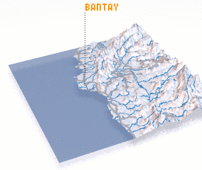 Places with similar names to Bantay, Philippines ::
Disclaimer :: Information on this page comes without warranty of any kind |
||
|
Where is Bantay? Elevation and coordinates ::
Latitude (lat): 17°35'5"N Longitude (lon): 120°23'21"E
Elevation (approx.): 17m (map arrows pan, magnifying glasses zoom) |
||
|
Visiting Bantay? Hotel/Accommodation ::
Book a hotel in Bantay Travel Guide ::
Buy a travel guide for Philippines rental cars ::
car rental offers GPS waypoint ::
download a GPX waypoint (PoI) of Bantay for your GPS receiver
|
||