|
search place name
|
||
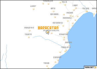
Baracatan (Davao del Sur, Philippines)Baracatan is a town in the Davao del Sur region of Philippines. An overview map of the region around Baracatan is displayed below.
regional and 3d topo map of Baracatan, Philippines ::
Baracatan airports ::
The nearest airport is CEB - Cebu Cotabato, located 135.0 km west of Baracatan.
Other airports nearby include CGY - Ladag Cagayan De Oro (182.9 km north west), LGP - Legazpi Pagadian (236.0 km north west), Nearby towns ::
Datu Tungkaling (1.3km north east) //
Matopangi (5.1km north east) //
Inawayan (6.2km east) //
Tinocol (6.2km east) //
Inuayan (6.5km north east) //
Bayabas (7.2km north) //
Binugao (7.3km east) //
Pandayan (7.5km west) //
Todaya (7.6km west) //
Astorga (8.2km south east) //
Sirawan (8.2km east) //
Darong (9.0km south east) //
Mampangi (9.1km north east) //
Bulan (9.1km south east) //
Tagulaya (9.2km south east) //
Bato (9.8km north east) //
Piedra (11.1km north east) //
[all distances 'as the bird flies' and approximate] 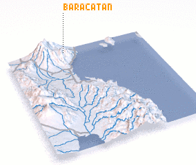 Places with similar names to Baracatan, Philippines ::
Disclaimer :: Information on this page comes without warranty of any kind |
||
|
Where is Baracatan? Elevation and coordinates ::
Latitude (lat): 6°58'10"N Longitude (lon): 125°24'58"E
Elevation (approx.): 445m (map arrows pan, magnifying glasses zoom) |
||
|
Visiting Baracatan? Hotel/Accommodation ::
Book a hotel in Baracatan Travel Guide ::
Buy a travel guide for Philippines rental cars ::
car rental offers GPS waypoint ::
download a GPX waypoint (PoI) of Baracatan for your GPS receiver
|
||