|
search place name
|
||
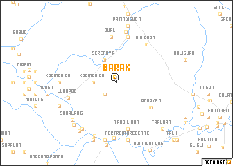
Barak (North Cotabato, Philippines)Barak is a town in the North Cotabato region of Philippines. An overview map of the region around Barak is displayed below.
regional and 3d topo map of Barak, Philippines ::
Barak airports ::
The nearest airport is CEB - Cebu Cotabato, located 34.3 km west of Barak.
Other airports nearby include LGP - Legazpi Pagadian (140.8 km north west), CGY - Ladag Cagayan De Oro (144.0 km north), Nearby towns ::
Balatalupa (2.6km south west) //
Kapinpilan (3.7km west) //
Serenaya (4.2km north west) //
Langayen (6.8km south east) //
Bual (7.5km north) //
Bakat (7.6km north) //
Tambiliban (7.6km south) //
Bulanan (7.9km north east) //
Lumopog (8.0km west) //
Midsayap (8.4km north) //
Samalang (9.2km south west) //
Liong (9.2km south west) //
Damatulan (9.3km south) //
Duaminanga (9.6km south west) //
Balanakan (9.8km south west) //
Tapunan (10.4km south east) //
Catilakan (10.4km south east) //
Duguan (10.4km south east) //
Luguilo (10.4km south east) //
Punolu (10.4km south east) //
Tapodok (10.4km south east) //
[all distances 'as the bird flies' and approximate] 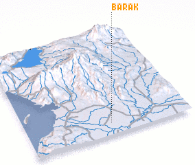 Places with similar names to Barak, Philippines ::
Disclaimer :: Information on this page comes without warranty of any kind |
||
|
Where is Barak? Elevation and coordinates ::
Latitude (lat): 7°7'0"N Longitude (lon): 124°31'0"E
Elevation (approx.): 6m (map arrows pan, magnifying glasses zoom) |
||
|
Visiting Barak? Hotel/Accommodation ::
Book a hotel in Barak Travel Guide ::
Buy a travel guide for Philippines rental cars ::
car rental offers GPS waypoint ::
download a GPX waypoint (PoI) of Barak for your GPS receiver
|
||