|
search place name
|
||
Bato (Negros Occidental, Philippines)Bato is a town in the Negros Occidental region of Philippines. An overview map of the region around Bato is displayed below.
regional and 3d topo map of Bato, Philippines ::

Bato airports ::
The nearest airport is BCD - Bacolod, located 51.9 km west of Bato.
Other airports nearby include NOP - Masbate Mactan Cebu Intl (86.8 km south east), ILO - Iloilo (91.1 km west), KLO - Kalibo (145.1 km north west), SJI - San Jose Antique (157.4 km west), Nearby towns ::
Tanao (3.5km north east) //
Makiling (4.1km south east) //
Bukidnon (4.4km north) //
Binabongol (4.7km east) //
Bairao (4.8km east) //
Calimonoc (5.0km east) //
Tadlong (5.9km north) //
Aropag (6.6km north) //
Malubon (6.6km north) //
Lubi (6.6km north west) //
Tamlang Viejo (6.7km east) //
Lopez Jaena (7.4km north east) //
Paraiso (8.0km north) //
Paitan (8.5km east) //
Fabrica (8.9km north) //
Rizal (9.0km north east) //
Luna (9.1km north east) //
[all distances 'as the bird flies' and approximate] 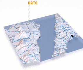 Places with similar names to Bato, Philippines ::
Disclaimer :: Information on this page comes without warranty of any kind |
||
|
Where is Bato? Elevation and coordinates ::
Latitude (lat): 10°48'41"N Longitude (lon): 123°22'19"E
Elevation (approx.): 94m (map arrows pan, magnifying glasses zoom) |
||
|
Visiting Bato? Hotel/Accommodation ::
Book a hotel in Bato Travel Guide ::
Buy a travel guide for Philippines rental cars ::
car rental offers GPS waypoint ::
download a GPX waypoint (PoI) of Bato for your GPS receiver
|
||