|
search place name
|
||
Batuti (Samar, Philippines)Batuti is a town in the Samar region of Philippines. An overview map of the region around Batuti is displayed below.
regional and 3d topo map of Batuti, Philippines ::

Batuti airports ::
The nearest airport is TAC - Tacloban Daniel Z Romualdez, located 78.7 km south of Batuti.
Other airports nearby include NOP - Masbate Mactan Cebu Intl (197.4 km south west), BCD - Bacolod (246.5 km south west), Nearby towns ::
Bonga Viejo (2.6km south) //
Cambatutay Nuevo (2.6km east) //
Margading (3.1km north) //
Lunbia (3.1km north east) //
Balugo (3.1km east) //
Mangcares (4.4km south) //
Arteche (4.4km east) //
Pajo (4.7km north east) //
Bahay (4.7km north east) //
Palencia (4.9km south east) //
Tarangnan (4.9km west) //
Gallego (5.0km west) //
Majacob (5.4km south) //
Cabangan (5.5km north west) //
Tizon (5.8km south east) //
Quezon (5.9km north east) //
Dapdap (7.2km north west) //
Marabut (7.3km south east) //
Pangi (7.8km north west) //
Villahermosa (8.4km north west) //
Pagsanghan (8.5km north west) //
San Luis (8.8km north) //
Cantaguic (8.7km east) //
Sapinit (9.7km north east) //
Pagsanghan (10.4km north west) //
Libas (11.0km south east) //
Palanas (11.1km north west) //
[all distances 'as the bird flies' and approximate] 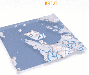 Places with similar names to Batuti, Philippines ::
Disclaimer :: Information on this page comes without warranty of any kind |
||
|
Where is Batuti? Elevation and coordinates ::
Latitude (lat): 11°54'2"N Longitude (lon): 124°47'35"E
Elevation (approx.): 47m (map arrows pan, magnifying glasses zoom) |
||
|
Visiting Batuti? Hotel/Accommodation ::
Book a hotel in Batuti Travel Guide ::
Buy a travel guide for Philippines rental cars ::
car rental offers GPS waypoint ::
download a GPX waypoint (PoI) of Batuti for your GPS receiver
|
||