|
search place name
|
||
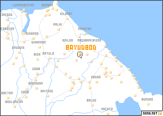
Bayudbod (Mindoro Oriental, Philippines)Bayudbod is a town in the Mindoro Oriental region of Philippines. An overview map of the region around Bayudbod is displayed below.
regional and 3d topo map of Bayudbod, Philippines ::
Bayudbod airports ::
The nearest airport is MNL - Manila Ninoy Aquino Intl, located 134.3 km north of Bayudbod.
Other airports nearby include KLO - Kalibo (218.5 km south east), Nearby towns ::
Gamao (1.3km south west) //
Bacungay (1.5km north east) //
Buhangin (2.3km east) //
Magindat (3.3km north west) //
Nag-iba Segundo (3.4km north east) //
Nag-iba Primero (3.5km north east) //
Lagonlongan (4.0km west) //
Anilao (4.1km north west) //
Sampaloc (4.6km east) //
Matandang Naujan (4.8km south) //
Gutad (5.0km north) //
Palbuticaan (5.1km south west) //
Barcanaga (5.1km south west) //
Managpi (5.3km west) //
Macasile (5.5km south) //
Naujan (5.5km east) //
Navotas (5.7km north) //
Pinagsabañgan (5.8km south) //
Mag-Asawang-Tubig (5.9km south) //
Canipsan (5.9km north east) //
Bucayao (5.9km west) //
Kalinisan (6.0km east) //
Garis (6.1km south) //
Ladron (6.4km south east) //
Mabini (6.4km south east) //
Madao (6.5km south east) //
Estrella (6.5km east) //
San Agustin (6.9km south east) //
Bolbog (7.2km south) //
[all distances 'as the bird flies' and approximate] 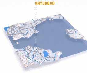
Disclaimer :: Information on this page comes without warranty of any kind |
||
|
Where is Bayudbod? Elevation and coordinates ::
Latitude (lat): 13°18'59"N Longitude (lon): 121°15'7"E
Elevation (approx.): 11m (map arrows pan, magnifying glasses zoom) |
||
|
Visiting Bayudbod? Hotel/Accommodation ::
Book a hotel in Bayudbod Travel Guide ::
Buy a travel guide for Philippines rental cars ::
car rental offers GPS waypoint ::
download a GPX waypoint (PoI) of Bayudbod for your GPS receiver
|
||