|
search place name
|
||
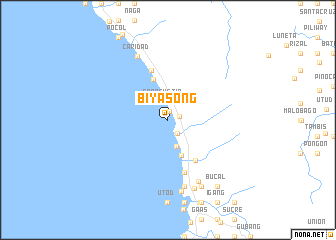
Biyasong (Leyte, Philippines)Biyasong is a town in the Leyte region of Philippines. An overview map of the region around Biyasong is displayed below.
regional and 3d topo map of Biyasong, Philippines ::
Biyasong airports ::
The nearest airport is TAC - Tacloban Daniel Z Romualdez, located 57.6 km north east of Biyasong.
Other airports nearby include NOP - Masbate Mactan Cebu Intl (101.6 km south west), BCD - Bacolod (203.3 km west), DGT - Dumaguete (227.0 km south west), Nearby towns ::
Bunga (1.0km north) //
Kanbanuy (1.3km east) //
Bartoline (1.8km south east) //
San Agustin (2.2km north) //
Lagolago (3.1km south) //
Gabas (4.2km south) //
Hilapintan (4.7km north) //
Mangbo (5.4km south east) //
Tugas (5.9km north) //
Kilim (6.2km south) //
Kandadam (7.6km south) //
Gakat (7.7km south east) //
Caridad (7.9km north west) //
Canadauam (8.1km south) //
Alkuino (8.2km south) //
Kiga (8.3km south east) //
Bucal (9.2km south east) //
[all distances 'as the bird flies' and approximate] 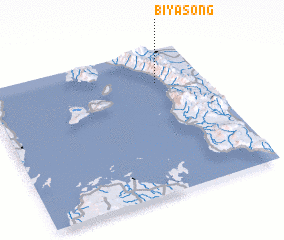 Places with similar names to Biyasong, Philippines ::
Disclaimer :: Information on this page comes without warranty of any kind |
||
|
Where is Biyasong? Elevation and coordinates ::
Latitude (lat): 10°46'0"N Longitude (lon): 124°47'0"E
Elevation (approx.): -32768m (map arrows pan, magnifying glasses zoom) |
||
|
Visiting Biyasong? Hotel/Accommodation ::
Book a hotel in Biyasong Travel Guide ::
Buy a travel guide for Philippines rental cars ::
car rental offers GPS waypoint ::
download a GPX waypoint (PoI) of Biyasong for your GPS receiver
|
||