|
search place name
|
||
Bud Dakula” (Sulu, Philippines)Bud Dakula” is a town in the Sulu region of Philippines. An overview map of the region around Bud Dakula” is displayed below.
regional and 3d topo map of Bud Dakula”, Philippines ::

Bud Dakula” airports ::
The nearest airport is ZAM - Zamboanga Intl, located 139.6 km north east of Bud Dakula”.
Nearby towns ::
Si”it Lake (0.0km north) //
Langhub (0.0km north) //
Pananaw (0.3km south west) //
Datag (1.2km south) //
Kamalig (1.4km east) //
Caduayan (1.9km north) //
Kansipati (2.8km north east) //
Bitanag (3.1km south east) //
Punay (3.2km south west) //
Baunoh (3.6km south east) //
Tubig Jati (3.9km east) //
Marsada (4.1km south) //
Takut (4.1km south west) //
New Panamao (4.1km south west) //
Kulay-Kulay (4.6km south) //
Bangday (4.9km east) //
Sū (5.2km north west) //
Tayungan (5.4km east) //
Pandakan (5.7km west) //
Bulangsi (5.7km north east) //
Libug Kabaw (5.7km east) //
Tiptipon (5.8km west) //
Tinah (5.8km east) //
Tabu” Manuk (5.9km south) //
Asin (6.0km south east) //
Kandayok (6.0km north west) //
Kawasan (6.2km south east) //
Kanlibot (6.4km west) //
Kulambo (6.7km west) //
[all distances 'as the bird flies' and approximate] 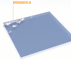 Places with similar names to Bud Dakula”, Philippines ::
Disclaimer :: Information on this page comes without warranty of any kind |
||
|
Where is Bud Dakula”? Elevation and coordinates ::
Latitude (lat): 5°59'0"N Longitude (lon): 121°13'0"E
Elevation (approx.): 16m (map arrows pan, magnifying glasses zoom) |
||
|
Visiting Bud Dakula”? Hotel/Accommodation ::
Book a hotel in Bud Dakula” Travel Guide ::
Buy a travel guide for Philippines rental cars ::
car rental offers GPS waypoint ::
download a GPX waypoint (PoI) of Bud Dakula” for your GPS receiver
|
||