|
search place name
|
||
Buduk (Lanao del Norte, Philippines)Buduk is a town in the Lanao del Norte region of Philippines. An overview map of the region around Buduk is displayed below.
regional and 3d topo map of Buduk, Philippines ::

Buduk airports ::
The nearest airport is LGP - Legazpi Pagadian, located 48.8 km west of Buduk.
Other airports nearby include CGY - Ladag Cagayan De Oro (94.4 km north east), CEB - Cebu Cotabato (98.2 km south), DGT - Dumaguete (161.7 km north west), ZAM - Zamboanga Intl (232.0 km south west), Nearby towns ::
Kiatobakan (0.6km south west) //
Kabuyao (1.1km west) //
Linduñgan (2.3km south) //
Kabasagan (2.7km north west) //
Baris (2.7km north west) //
Lindungan (3.3km south west) //
Baras (4.4km west) //
Dalama (5.0km south) //
Kabasagan (5.0km south west) //
Balintad (5.9km south) //
Pingping (6.1km north west) //
Buntong (7.3km north east) //
Lauan (7.5km west) //
Pangi (7.5km west) //
Pindulangan (8.0km south west) //
Magsaysay (8.6km north east) //
Looc (9.0km north west) //
Karkum (10.2km south east) //
Bulod (10.3km north west) //
Tubod (11.5km north west) //
[all distances 'as the bird flies' and approximate] 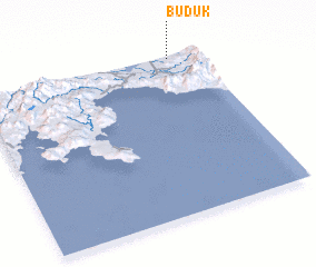 Places with similar names to Buduk, Philippines ::
Disclaimer :: Information on this page comes without warranty of any kind |
||
|
Where is Buduk? Elevation and coordinates ::
Latitude (lat): 7°59'12"N Longitude (lon): 123°52'14"E
Elevation (approx.): 114m (map arrows pan, magnifying glasses zoom) |
||
|
Visiting Buduk? Hotel/Accommodation ::
Book a hotel in Buduk Travel Guide ::
Buy a travel guide for Philippines rental cars ::
car rental offers GPS waypoint ::
download a GPX waypoint (PoI) of Buduk for your GPS receiver
|
||