|
search place name
|
||
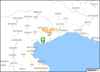
Bulanit (Zamboanga del Sur, Philippines)Bulanit is a town in the Zamboanga del Sur region of Philippines. An overview map of the region around Bulanit is displayed below.
regional and 3d topo map of Bulanit, Philippines ::
Bulanit airports ::
The nearest airport is LGP - Legazpi Pagadian, located 3.0 km south west of Bulanit.
Other airports nearby include CEB - Cebu Cotabato (109.6 km south east), CGY - Ladag Cagayan De Oro (139.8 km north east), DGT - Dumaguete (166.5 km north), ZAM - Zamboanga Intl (187.0 km south west), Nearby towns ::
Maliang (0.7km south) //
Tawagan (1.0km north west) //
Bulaniog (1.0km north east) //
Muricay (1.5km south) //
Deguma (2.2km west) //
Balaniug (2.5km south) //
Marum (2.6km south west) //
Santa Cruz (3.4km north west) //
Giel (3.6km east) //
Upper Tawagan (4.0km east) //
Labangan (4.4km north east) //
Lantian (5.1km north east) //
Pagadian (5.2km west) //
Dao (5.7km west) //
Balangasan (6.8km west) //
Katituan (7.1km north east) //
Luya (8.0km north east) //
Bukon (8.1km north) //
Balintawak (8.1km west) //
Bogo (8.1km north west) //
Banale (8.1km west) //
Poloyagan (8.3km south west) //
Bayon (8.7km east) //
Bogo (9.0km west) //
Binayan (9.2km north west) //
Matabang (9.5km south west) //
Pantad (9.8km south west) //
Masom (9.8km south west) //
Datagon (10.3km north west) //
[all distances 'as the bird flies' and approximate] 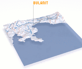 Places with similar names to Bulanit, Philippines ::
Disclaimer :: Information on this page comes without warranty of any kind |
||
|
Where is Bulanit? Elevation and coordinates ::
Latitude (lat): 7°50'22"N Longitude (lon): 123°28'56"E
Elevation (approx.): 5m (map arrows pan, magnifying glasses zoom) |
||
|
Visiting Bulanit? Hotel/Accommodation ::
Book a hotel in Bulanit Travel Guide ::
Buy a travel guide for Philippines rental cars ::
car rental offers GPS waypoint ::
download a GPX waypoint (PoI) of Bulanit for your GPS receiver
|
||